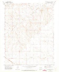
1971 Map of Mc Endree Ranch
USGS Topo · Published 1973About this map
Brookfield (Site) occupies a high terrace in the northern reaches of this Colorado plains landscape, appearing here as a remnant of earlier settlement patterns in Baca County. The terrain is defined by the incision of Snake Arroyo and the drainage of Butte Creek, which carve through the high ground before meeting the broader basins of North Horse Creek and South Horse Creek to the south. Near the center of the sheet, the McEndree Ranch serves as a primary landmark, while the Maxey City and Cem provides a specific point of interest for genealogists tracing early families in this corner of the state.
Find a feature on this map
16 named features on this map. Tap any name to fly to it.
Don’t see what you’re looking for? This feature index may not catch every label — zoom into the map to look around manually.
Map Details
Editions of this 1971 Mc Endree Ranch Map
This is the sole edition of this map. No revisions or reprints were ever made.
Other maps of this area

1891 · Springfield
USGS Topo · 1:125,000

1892 · Two Butte
USGS Topo · 1:125,000

1893 · Two Butte
USGS Topo · 1:125,000

1893 · Springfield
USGS Topo · 1:125,000

1955 · La Junta
USGS Topo · 1:250,000

1958 · La Junta
USGS Topo · 1:250,000

1968 · La Junta
USGS Topo · 1:250,000
1971 · Big Rock Grange
USGS Topo · 1:24,000
1971 · Deora
USGS Topo · 1:24,000
1971 · Floating W Ranch
USGS Topo · 1:24,000