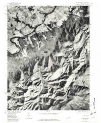
1977 Map of Mc Gaheysville
USGS Topo · Published 1982About this map
The South Fork Shenandoah River carves a winding path through this portion of Rockingham County, separating the agricultural lowlands from the rising elevations of the Blue Ridge. This orthophotoquad, produced from 1977 aerial imagery, reveals the precise field patterns and rural infrastructure surrounding Mc Gaheysville and Rocky Bar. The sharp contrast between the geometric farm plots in the valley and the dense timber of Rocky Mountain illustrates the historical relationship between topography and settlement.
Find a feature on this map
13 named features on this map. Tap any name to fly to it.
Don’t see what you’re looking for? This feature index may not catch every label — zoom into the map to look around manually.
Map Details
Editions of this 1977 Mc Gaheysville Map
This is the sole edition of this map. No revisions or reprints were ever made.
Other maps of this area

1892 · Harrisonburg
USGS Topo · 1:125,000

1931 · University
USGS Topo · 1:62,500

1934 · Waynesboro
USGS Topo · 1:48,000

1935 · University
USGS Topo · 1:62,500

1937 · Elkton
USGS Topo · 1:62,500

1939 · Waynesboro
USGS Topo · 1:62,500

1941 · Harrisonburg
USGS Topo · 1:62,500

1943 · Harrisonburg
USGS Topo · 1:62,500

1949 · Charlottesville
USGS Topo · 1:250,000

1956 · Charlottesville
USGS Topo · 1:250,000