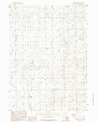
1984 Map of Mc Kenzie Flat
USGS Topo · Published 1984About this map
Mc Kenzie Flat is a high desert plateau characterized by a network of seasonal watercourses and ephemeral features in the center of Natrona County. During the late 1970s and early 1980s, this area of the high plains was mapped to show its reliance on isolated water sources like Mud Spring and the drainage systems of Mc Kenzie Creek and Meyers Draw. The presence of Sand Springs and Mud Lake suggests a landscape defined by traditional ranching and livestock movement, where every named watering hole served as a vital landmark for navigation and survival in an arid environment. This 1984 provisional edition highlights the topographic nuances of the Antelope region, documenting the land as it appeared before modern development or changing land-use patterns significantly altered these open range spaces.
Find a feature on this map
9 named features on this map. Tap any name to fly to it.
Don’t see what you’re looking for? This feature index may not catch every label — zoom into the map to look around manually.
Map Details
Editions of this 1984 Mc Kenzie Flat Map
2 editions found
Other maps of this area

1949 · Campbell Hill
USGS Topo · 1:24,000

1949 · Pratts Soda Lakes
USGS Topo · 1:24,000

1950 · Campbell Hill
USGS Topo · 1:24,000

1950 · Pratts Soda Lakes
USGS Topo · 1:24,000

1951 · The Reefs
USGS Topo · 1:24,000

1955 · Arminto
USGS Topo · 1:250,000

1955 · Casper
USGS Topo · 1:250,000

1958 · Casper
USGS Topo · 1:250,000

1958 · Arminto
USGS Topo · 1:250,000

1959 · Ormsby Draw
USGS Topo · 1:62,500