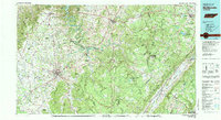
1981 Map of Mc Minnville
USGS Topo · Published 1981About this map
Cumberland Plateau terrain dominates the eastern portion of this regional survey, dropping sharply along the Cumberland Escarpment into the Sequatchie Valley. The Tennessee Valley Authority cooperated in this study, which highlights the transition from the high ridges of Walden Ridge to the fertile lowlands surrounding McMinnville. Water is a central theme, with the winding course of the Caney Fork and Center Hill Lake providing a backdrop for numerous small settlements like Dowelltown, Gassaway, and Liberty.
Find a feature on this map
202 named features on this map. Tap any name to fly to it.
Don’t see what you’re looking for? This feature index may not catch every label — zoom into the map to look around manually.
Map Details
Editions of this 1981 Mc Minnville Map
This is the sole edition of this map. No revisions or reprints were ever made.
Other maps of this area

1886 · Cleveland
USGS Topo · 1:125,000

1887 · Kingston
USGS Topo · 1:125,000

1888 · Chattanooga
USGS Topo · 1:125,000

1891 · Kingston
USGS Topo · 1:125,000

1892 · Pikeville
USGS Topo · 1:125,000

1892 · Cleveland
USGS Topo · 1:125,000

1893 · Mc Minnville
USGS Topo · 1:125,000

1893 · Chattanooga
USGS Topo · 1:125,000

1893 · Kingston
USGS Topo · 1:125,000

1895 · Cleveland
USGS Topo · 1:125,000