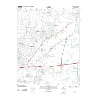
2011 Map of McAlmont
USGS Topo · Published 2011About this map
North Little Rock and Sherwood dominate this 2011 survey, showcasing a landscape defined by suburban expansion and a sophisticated network of water management features. The area is densely packed with residential developments like Sylvan Hills, Autumnbrook, and Silver Creek, many of which are built around engineered water bodies including Lake Cherrywood, Lakewood Lake Number One, and Peeler Lake. These reservoirs, managed by structures like the Lakewood Lake Number One Dam, illustrate how the drainage of Fivemile Creek and Gap Creek has been integrated into the local neighborhood design.
Find a feature on this map
115 named features on this map. Tap any name to fly to it.
Don’t see what you’re looking for? This feature index may not catch every label — zoom into the map to look around manually.
Map Details
Editions of this 2011 McAlmont Map
This is the sole edition of this map. No revisions or reprints were ever made.
Other maps of this area

1891 · Little Rock
USGS Topo · 1:125,000

1893 · Little Rock
USGS Topo · 1:125,000

1935 · Mc Almont
USGS Topo · 1:24,000

1935 · Little Rock
USGS Topo · 1:24,000

1935 · Sweet Home
USGS Topo · 1:24,000

1935 · North Little Rock
USGS Topo · 1:24,000

1935 · Alexander
USGS Topo · 1:48,000

1941 · Alexander
USGS Topo · 1:62,500

1941 · Olmstead
USGS Topo · 1:31,680

1941 · Cabot
USGS Topo · 1:31,680