
1941 Map of Olmstead
USGS Topo · Published 1945About this map
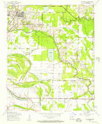
Olmstead and the surrounding rural communities of northern Pulaski County are defined by a complex drainage system where Little Bayou Meto and Bayou Meto snake through the lowlands between prominent elevations. Surveyed just before the United States entered World War II, the landscape is dotted with small-scale agricultural landmarks, including Tates Mill and a series of rural schools such as Faulkner Gap Sch and Bayou Meto Sch. The rugged terrain is punctuated by distinctive landforms like Backbone Ridge, Flat Rock Mtn, and Prairie Peak, which dictated the early road networks including the historic Batesville Road. This 1941 snapshot preserves the locations of numerous community anchors, from Mt Chapel Ch to the Sumner Cem, providing a clear view of the settlement patterns along the Faulkner and Pulaski county line before post-war modernization altered the local character.
Find a feature on this map
38 named features on this map. Tap any name to fly to it.
Don’t see what you’re looking for? This feature index may not catch every label — zoom into the map to look around manually.
Map Details
Editions of this 1941 Olmstead Map
This is the sole edition of this map. No revisions or reprints were ever made.
Other maps of this area

1891 · Little Rock
USGS Topo · 1:125,000

1893 · Little Rock
USGS Topo · 1:125,000

1935 · Mc Almont
USGS Topo · 1:24,000

1935 · North Little Rock
USGS Topo · 1:24,000

1941 · Cabot
USGS Topo · 1:31,680

1943 · Jacksonville
USGS Topo · 1:31,680

1953 · Cato
USGS Topo · 1:24,000

1954 · Mc Almont
USGS Topo · 1:24,000

1954 · Olmstead
USGS Topo · 1:24,000
1954 · Jacksonville
USGS Topo · 1:24,000