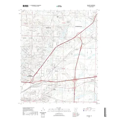
2020 Map of McAlmont
USGS Topo · Published 2020About this map
North Little Rock and its eastern suburbs are defined by a complex network of transportation corridors and water bodies. The sprawling neighborhoods of Sherwood, Jacksonville, and Sylvan Hills occupy the higher ground, while the southeastern portion of the map reveals the low-lying basins of Faulkner Lake and Ink Bayou. This transition from urban centers to alluvial plains is marked by significant industrial and transit infrastructure, including the Union Pacific railroad and major highway junctions like Protho Junction.
Find a feature on this map
104 named features on this map. Tap any name to fly to it.
Don’t see what you’re looking for? This feature index may not catch every label — zoom into the map to look around manually.
Map Details
Editions of this 2020 McAlmont Map
This is the sole edition of this map. No revisions or reprints were ever made.
Other maps of this area

1891 · Little Rock
USGS Topo · 1:125,000

1893 · Little Rock
USGS Topo · 1:125,000

1935 · Mc Almont
USGS Topo · 1:24,000

1935 · Little Rock
USGS Topo · 1:24,000

1935 · Sweet Home
USGS Topo · 1:24,000

1935 · North Little Rock
USGS Topo · 1:24,000

1935 · Alexander
USGS Topo · 1:48,000

1941 · Alexander
USGS Topo · 1:62,500

1941 · Olmstead
USGS Topo · 1:31,680

1941 · Cabot
USGS Topo · 1:31,680