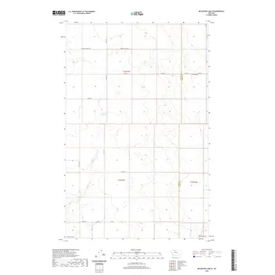
2020 Map of McCarters Lake SE
USGS Topo · Published 2020About this map
The Toole and Liberty County line divides this agricultural landscape, where the grain-farming economy is clearly articulated through a grid of rural section roads. These routes, including Galata Rd and Jap Evans Rd, reflect the legacy of homesteading and early education in the High Plains, evidenced by the corridor along Green Hill School Rd and Green Hill School E. Water management remains central to life here, with the Childrers Reservoir providing essential storage amidst the drainage patterns of Kinyon Coulee and Galata Ravine. The map reveals a land structured by the Public Land Survey System, with townships like t33n r3e and t32n r4e defining the territorial layout of this northern Montana region during the early twenty-first century.
Find a feature on this map
19 named features on this map. Tap any name to fly to it.
Don’t see what you’re looking for? This feature index may not catch every label — zoom into the map to look around manually.
Map Details
Editions of this 2020 McCarters Lake SE Map
This is the sole edition of this map. No revisions or reprints were ever made.
Other maps of this area

1954 · Shelby
USGS Topo · 1:250,000

1958 · Shelby
USGS Topo · 1:250,000

1962 · North Lothair School
USGS Topo · 1:24,000

1962 · Hawthorne School
USGS Topo · 1:24,000

1962 · Berkholder Reservoir
USGS Topo · 1:24,000

1962 · Mc Carters Lake
USGS Topo · 1:24,000

1962 · Blair Ranch
USGS Topo · 1:24,000

1962 · Mc Carters Lake SE
USGS Topo · 1:24,000

1970 · Devon
USGS Topo · 1:24,000

1970 · Galata
USGS Topo · 1:24,000