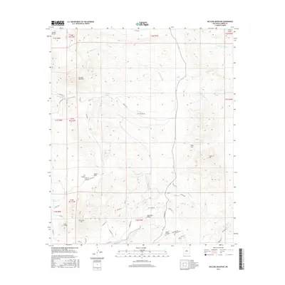
2017 Map of McClede Mountain
USGS Topo · Published 2017About this map
McClede Mountain rises as the central topographic feature of this high-elevation Sierra County landscape. The drainage network is complex, characterized by seasonal water sources such as McClede Spring and O Bar O Spring, which feed into various creeks and arroyos. The southern portion of the quadrangle is defined by the significant rise of Berrenda Mtn and the prominent Quartzite Ridge. Historically, this area is marked by a network of back-country trails and ranch roads, including Mangas Trl and Victorio Trl, which navigate the deep cuts of P A Canyon and Taylor Canyon. The terrain shows a transition from the lower Tierra Blanca Cr and Jaralosa Cr basins up toward the high peaks and gaps, such as Sibley Gap, reflecting the challenging geography of the northern Black Range region.
Find a feature on this map
51 named features on this map. Tap any name to fly to it.
Don’t see what you’re looking for? This feature index may not catch every label — zoom into the map to look around manually.
Map Details
Editions of this 2017 McClede Mountain Map
This is the sole edition of this map. No revisions or reprints were ever made.
Other maps of this area

1935 · Hillsboro
USGS Topo · 1:48,000

1940 · Hillsboro
USGS Topo · 1:62,500

1955 · Las Cruces
USGS Topo · 1:250,000

1958 · Las Cruces
USGS Topo · 1:250,000

1961 · Skute Stone Arroyo
USGS Topo · 1:24,000

1961 · Nutt
USGS Topo · 1:62,500

1961 · Clark Spring Canyon
USGS Topo · 1:24,000

1962 · Lake Valley
USGS Topo · 1:62,500

1982 · Hatch
USGS Topo · 1:100,000
1985 · P A Mountain
USGS Topo · 1:24,000