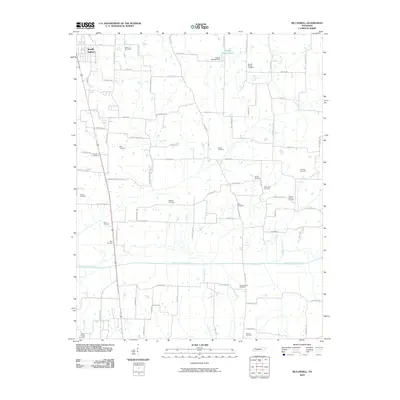
2010 Map of McConnell
USGS Topo · Published 2010About this map
The North Fork Obion River meanders across the southern landscape of this Tennessee quadrangle, defining a broad floodplain that separates the northern uplands from the scattered settlements to the south. In the northwest, the edge of South Fulton marks a point of urban transition, while the surrounding countryside is characterized by a dense network of family-named roads and burial grounds. For genealogists, the map is a remarkable record of legacy, featuring numerous small plots such as Mount Moriah Cemetery, Obion Chapel Cemetery, and the Camp Ground Cemetery.
Find a feature on this map
80 named features on this map. Tap any name to fly to it.
Don’t see what you’re looking for? This feature index may not catch every label — zoom into the map to look around manually.
Map Details
Editions of this 2010 McConnell Map
This is the sole edition of this map. No revisions or reprints were ever made.
Other maps of this area

1950 · Martin
USGS Topo · 1:24,000

1952 · Crutchfield
USGS Topo · 1:24,000

1952 · Dresden
USGS Topo · 1:24,000

1952 · Cuba
USGS Topo · 1:24,000

1952 · Water Valley
USGS Topo · 1:24,000

1952 · Mayfield
USGS Topo · 1:62,500

1952 · Water Valley
USGS Topo · 1:62,500

1956 · Gardner
USGS Topo · 1:24,000

1956 · Harris
USGS Topo · 1:24,000

1956 · Mc Connell
USGS Topo · 1:24,000