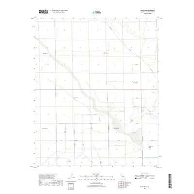
2018 Map of McCoy Wash
USGS Topo · Published 2018About this map
Palo Verde Mesa defines the western landscape of this Riverside County region, dropping down into the productive agricultural lands of the Palo Verde Valley. The city of Blythe sits at the eastern edge of the survey, serving as a regional hub alongside the nearby Palo Verde College and the expansive Blythe Airport. The namesake McCoy Wash cuts diagonally across the center of the sheet, illustrating the drainage patterns that shaped the local topography before reaching the irrigated farm plots below.
Find a feature on this map
36 named features on this map. Tap any name to fly to it.
Don’t see what you’re looking for? This feature index may not catch every label — zoom into the map to look around manually.
Map Details
Editions of this 2018 McCoy Wash Map
This is the sole edition of this map. No revisions or reprints were ever made.
Other maps of this area

1942 · Blythe
USGS Topo · 1:250,000

1945 · Big Maria Mtns
USGS Topo · 1:62,500

1945 · Midland
USGS Topo · 1:62,500

1951 · Big Maria Mts
USGS Topo · 1:62,500

1951 · Blythe
USGS Topo · 1:24,000

1951 · McCoy Wash
USGS Topo · 1:24,000

1951 · Blythe NE
USGS Topo · 1:24,000

1952 · Midland
USGS Topo · 1:62,500

1952 · Mc Coy Spring
USGS Topo · 1:62,500

1952 · Ripley
USGS Topo · 1:24,000