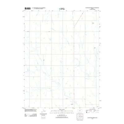
2012 Map of McCracken Branch
USGS Topo · Published 2012About this map
White Rock Creek and its many tributaries, including the namesake McCracken Branch, carve a complex drainage pattern across this section of Jewell County. The landscape is defined by the steady intersection of rural section-line roads like Womer Road and County Road 630, which support a dispersed agricultural community. This 2012 survey illustrates the long-term settlement patterns of the region through its preservation of several local burial grounds, including Webb Hill Cemetery and Oriole Cemetery. Near the southern edge, Pleasant Plains Cemetery and Salem Cemetery sit among the headwaters of Pawnee Creek, while the presence of Shute Airport in the northeast corner indicates the continued importance of private aviation in the modern Kansas prairie. The map provides a precise look at the hydrology of the High Plains, tracing small watercourses like Louisa Creek and West Penny Creek.
Find a feature on this map
16 named features on this map. Tap any name to fly to it.
Don’t see what you’re looking for? This feature index may not catch every label — zoom into the map to look around manually.
Map Details
Editions of this 2012 McCracken Branch Map
This is the sole edition of this map. No revisions or reprints were ever made.
Other maps of this area

1893 · Smith Center
USGS Topo · 1:125,000

1894 · Mankato
USGS Topo · 1:125,000

1897 · Red Cloud
USGS Topo · 1:125,000

1898 · Superior
USGS Topo · 1:125,000

1940 · Red Cloud
USGS Topo · 1:62,500

1942 · Red Cloud
USGS Topo · 1:62,500

1955 · Grand Island
USGS Topo · 1:250,000

1955 · Beloit
USGS Topo · 1:250,000

1957 · Grand Island
USGS Topo · 1:250,000

1958 · Grand Island
USGS Topo · 1:250,000