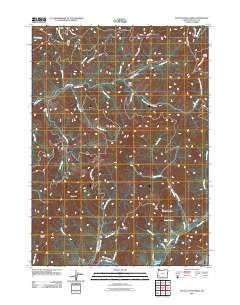
2011 Map of McCullough Creek
USGS Topo · Published 2011About this map
Fir Point Christian Camp and several forestry-related outposts define this stretch of Douglas County, where the landscape is carved by an intricate network of waterways flowing toward the McCullough Creek drainage. The map reveals a region dominated by logging and resource management, evidenced by the dense grid of Bureau of Land Management roads, such as BLM 31-6-17.0 RD and The Fire Tower Rd, which provide access to high points like Silver Butte. Small, named settlements and landings like Cedar Camp, South Fork Camp, and Grayback suggest a history of seasonal or industrial habitation tied to the timber industry. Numerous springs, including Bernstein Spring and Flory Spring, feed into the various forks of Middle Creek, highlighting the importance of freshwater sources in this high-elevation terrain before they gather at Hayward Pond in the southern reaches.
Find a feature on this map
47 named features on this map. Tap any name to fly to it.
Don’t see what you’re looking for? This feature index may not catch every label — zoom into the map to look around manually.
Map Details
Editions of this 2011 McCullough Creek Map
This is the sole edition of this map. No revisions or reprints were ever made.
Other maps of this area

1904 · Riddle
USGS Topo · 1:125,000

1946 · Galice
USGS Topo · 1:62,500

1946 · Dutchman Butte
USGS Topo · 1:62,500

1948 · Galice
USGS Topo · 1:62,500

1948 · Dutchman Butte
USGS Topo · 1:62,500

1954 · Glendale
USGS Topo · 1:62,500

1954 · Canyonville
USGS Topo · 1:62,500

1955 · Medford
USGS Topo · 1:250,000

1957 · Medford
USGS Topo · 1:250,000

1958 · Medford
USGS Topo · 1:250,000