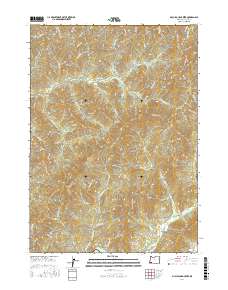
2017 Map of McCullough Creek
USGS Topo · Published 2017About this map
Grayback and the high ridges of Douglas County define this landscape of the Southern Oregon interior, where timber management and rugged hydrology converge. The map documents an extensive network of forest access routes including the McCullough Creek Rd, Silver Butte Rd, and numerous Bureau of Land Management spurs like BLM RD 31-6-17.0. These roads trace the steep drainages of McCullough Creek and Middle Creek, following the complex topography that rises toward Silver Butte and Panther Butte.
Find a feature on this map
75 named features on this map. Tap any name to fly to it.
Don’t see what you’re looking for? This feature index may not catch every label — zoom into the map to look around manually.
Map Details
Editions of this 2017 McCullough Creek Map
This is the sole edition of this map. No revisions or reprints were ever made.
Other maps of this area

1904 · Riddle
USGS Topo · 1:125,000

1946 · Galice
USGS Topo · 1:62,500

1946 · Dutchman Butte
USGS Topo · 1:62,500

1948 · Galice
USGS Topo · 1:62,500

1948 · Dutchman Butte
USGS Topo · 1:62,500

1954 · Glendale
USGS Topo · 1:62,500

1954 · Canyonville
USGS Topo · 1:62,500

1955 · Medford
USGS Topo · 1:250,000

1957 · Medford
USGS Topo · 1:250,000

1958 · Medford
USGS Topo · 1:250,000