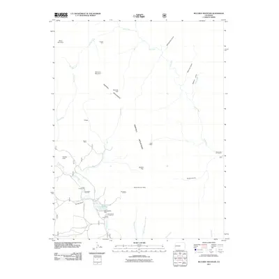
2011 Map of McCurdy Mountain
USGS Topo · Published 2011About this map
Tarryall Mountains dominate this high-altitude landscape of central Colorado, where geological features and mining history intersect. The map documents industrial traces such as the Lost Park Mine in the north and the Bearcat Mines further south, illustrating the era's mineral exploration. Water management is centered on the Bayou Salado Reservoir and its corresponding Bayou Salado Dam, which feed into the drainage network of Tarryall Creek.
Find a feature on this map
35 named features on this map. Tap any name to fly to it.
Don’t see what you’re looking for? This feature index may not catch every label — zoom into the map to look around manually.
Map Details
Editions of this 2011 McCurdy Mountain Map
This is the sole edition of this map. No revisions or reprints were ever made.
Other maps of this area

1893 · Platte Canyon
USGS Topo · 1:125,000

1953 · Denver
USGS Topo · 1:250,000

1954 · Green Mountain
USGS Topo · 1:24,000
1954 · Windy Peak
USGS Topo · 1:24,000

1956 · Mc Curdy Mountain
USGS Topo · 1:24,000

1956 · Tarryall
USGS Topo · 1:24,000

1956 · Hackett Mountain
USGS Topo · 1:24,000

1956 · Farnum Peak
USGS Topo · 1:24,000
1956 · Cheesman Lake
USGS Topo · 1:24,000

1956 · Glentivar
USGS Topo · 1:24,000