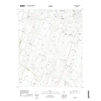
2019 Map of McDonald
USGS Topo · Published 2019About this map
Cleveland and its southwestern suburbs form the northern edge of this study, where the landscape transitions into a series of distinct ridges and valleys. The Tennessee Valley Divide cuts through the center of the sheet, separating the drainages of Black Fox Creek and Candies Creek. Evidence of early industrial activity remains in the place names of Lead Mine Ridge and Lead Mine Valley, while the rural character of the area is anchored by numerous small family and community burial grounds, such as Bethel Cemetery and Antioch Cemetery. Small settlements like McDonald and Flint Springs are connected by a network of local roads such as Old Chattanooga Road and Old Alabama Road SW, which follow the natural contours of the land. Geographic landmarks like Maroon Gap and Sugarloaf Knob punctuate the ridges, providing a clear picture of the topography that shaped local development.
Find a feature on this map
183 named features on this map. Tap any name to fly to it.
Don’t see what you’re looking for? This feature index may not catch every label — zoom into the map to look around manually.
Map Details
Editions of this 2019 McDonald Map
This is the sole edition of this map. No revisions or reprints were ever made.
Other maps of this area

1886 · Dalton
USGS Topo · 1:125,000

1886 · Cleveland
USGS Topo · 1:125,000

1886 · Ringgold
USGS Topo · 1:125,000

1888 · Chattanooga
USGS Topo · 1:125,000

1892 · Ringgold
USGS Topo · 1:125,000

1892 · Cleveland
USGS Topo · 1:125,000

1892 · Dalton
USGS Topo · 1:125,000

1893 · Chattanooga
USGS Topo · 1:125,000

1895 · Cleveland
USGS Topo · 1:125,000

1897 · Dalton
USGS Topo · 1:125,000