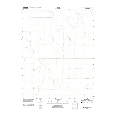
2010 Map of McEndree Ranch
USGS Topo · Published 2010About this map
McEndree Ranch and the Maxey Cemetery stand as primary landmarks in this sparsely populated portion of Baca County. This 2010 survey reveals a landscape shaped by intermittent watercourses, where Two Butte Creek winds through the northern half of the quadrangle while North Horse Creek and South Horse Creek define the southern drainage patterns. The grid of the High Plains is evident through a network of local thoroughfares including County Road VV, County Road RR, and County Road NN, which provide access to the isolated ranching operations and family burial grounds that characterize this region. Small tributaries like Maverick Creek and the dry bed of Snake Arroyo emphasize the arid nature of the terrain during this era of modern land management.
Find a feature on this map
21 named features on this map. Tap any name to fly to it.
Don’t see what you’re looking for? This feature index may not catch every label — zoom into the map to look around manually.
Map Details
Editions of this 2010 McEndree Ranch Map
This is the sole edition of this map. No revisions or reprints were ever made.
Other maps of this area

1891 · Springfield
USGS Topo · 1:125,000

1892 · Two Butte
USGS Topo · 1:125,000

1893 · Two Butte
USGS Topo · 1:125,000

1893 · Springfield
USGS Topo · 1:125,000

1955 · La Junta
USGS Topo · 1:250,000

1958 · La Junta
USGS Topo · 1:250,000

1968 · La Junta
USGS Topo · 1:250,000
1971 · Big Rock Grange
USGS Topo · 1:24,000
1971 · Mc Endree Ranch
USGS Topo · 1:24,000
1971 · Deora
USGS Topo · 1:24,000