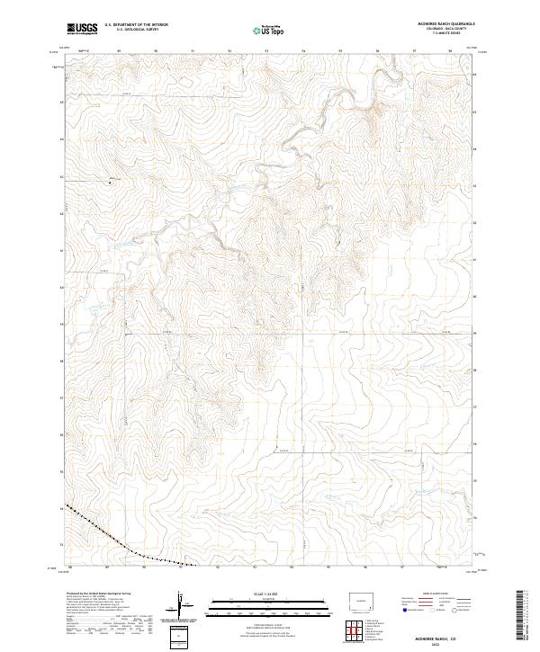
2022 Map of McEndree Ranch
USGS Topo · Published 2022About this map
The Maxey Cem serves as a lonely genealogical marker on this high plains landscape of Baca County. Set against a backdrop of drainage networks like Snake Arroyo and Maverick Cr, the map reveals a terrain defined by its watercourses rather than dense settlement. The land is organized by a sparse but regular grid of county roads, including Co RD RR and Co RD PP, which traverse the open range between northern and southern branches of the local creek systems. This modern survey reflects the enduring cattle ranching character of the region, where the Two Butte Cr and N Horse Cr valleys provide the primary geographic structure for the surrounding rangeland.
Find a feature on this map
19 named features on this map. Tap any name to fly to it.
Don’t see what you’re looking for? This feature index may not catch every label — zoom into the map to look around manually.
Map Details
Editions of this 2022 McEndree Ranch Map
This is the sole edition of this map. No revisions or reprints were ever made.
Other maps of this area

1891 · Springfield
USGS Topo · 1:125,000

1892 · Two Butte
USGS Topo · 1:125,000

1893 · Two Butte
USGS Topo · 1:125,000

1893 · Springfield
USGS Topo · 1:125,000

1955 · La Junta
USGS Topo · 1:250,000

1958 · La Junta
USGS Topo · 1:250,000

1968 · La Junta
USGS Topo · 1:250,000
1971 · Big Rock Grange
USGS Topo · 1:24,000
1971 · Mc Endree Ranch
USGS Topo · 1:24,000
1971 · Deora
USGS Topo · 1:24,000