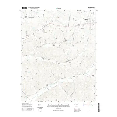
2016 Map of McEwen
USGS Topo · Published 2016About this map
McEwen and Gorman anchor this central Tennessee landscape, where the terrain is defined by a dense network of hollows and ridges typical of the Western Highland Rim. The map reveals a land heavily shaped by its hydrology, with Hurricane Creek and Little Blue Cr carving deep into the topography, creating family-named landmarks like Jones Hollow and Trogden Hollow. Local history is preserved in the numerous small burial grounds scattered throughout the hills, including Bethel Cem, Chambers Cem, and Scurlock Cem. Transportation patterns here follow the winding valleys, with Saint Patrick St and Old Nashville Hwy serving the growing community of McEwen. The presence of the Humphreys County Airport near Stephany Ridge suggests the modern evolution of this rural area, while numerous natural springs like Breadens Spring and Shiloh Spring point to the enduring reliance on the local watershed for settlement and agriculture.
Find a feature on this map
118 named features on this map. Tap any name to fly to it.
Don’t see what you’re looking for? This feature index may not catch every label — zoom into the map to look around manually.
Map Details
Editions of this 2016 McEwen Map
This is the sole edition of this map. No revisions or reprints were ever made.
Other maps of this area

1936 · Gorman
USGS Topo · 1:24,000

1936 · Hurricane Mills
USGS Topo · 1:24,000

1936 · Woolworth
USGS Topo · 1:24,000

1936 · Ruskin
USGS Topo · 1:24,000

1936 · Bucksnort
USGS Topo · 1:24,000

1936 · Halls Creek
USGS Topo · 1:24,000

1936 · Spot
USGS Topo · 1:24,000

1936 · Waverly
USGS Topo · 1:24,000

1936 · Tennessee City
USGS Topo · 1:24,000

1950 · Halls Creek
USGS Topo · 1:24,000