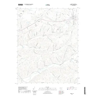
2019 Map of McEwen
USGS Topo · Published 2019About this map
McEwen and Waverly anchor this detailed landscape in Humphreys County, where the CSX Transportation railroad line cuts through a series of hollows and ridges. The terrain is deeply articulated by family-named hollows such as Wyly Hollow, Trogden Hollow, and Bushwacker Hollow, illustrating a settlement pattern long defined by the area's intricate drainage systems. Local history is preserved in numerous upland burial grounds, including the Anderson Cem, Bethpage Cem, and Scurlock Cem, which are often found on the rises above watercourses like Little Blue Cr and Hurricane Creek. Near the eastern edge of the map, McEwen High Sch and the Bethel Ch serve as community landmarks, while the Humphreys County Airport marks the northwestern corner. The map also records several natural springs, such as Long Spring and Simpson Spring, which historically influenced the placement of homesteads in this part of Tennessee.
Find a feature on this map
127 named features on this map. Tap any name to fly to it.
Don’t see what you’re looking for? This feature index may not catch every label — zoom into the map to look around manually.
Map Details
Editions of this 2019 McEwen Map
This is the sole edition of this map. No revisions or reprints were ever made.
Other maps of this area

1936 · Gorman
USGS Topo · 1:24,000

1936 · Hurricane Mills
USGS Topo · 1:24,000

1936 · Woolworth
USGS Topo · 1:24,000

1936 · Ruskin
USGS Topo · 1:24,000

1936 · Bucksnort
USGS Topo · 1:24,000

1936 · Halls Creek
USGS Topo · 1:24,000

1936 · Spot
USGS Topo · 1:24,000

1936 · Waverly
USGS Topo · 1:24,000

1936 · Tennessee City
USGS Topo · 1:24,000

1950 · Halls Creek
USGS Topo · 1:24,000