2022 Map of McEwen
USGS Topo · Published 2022About this map
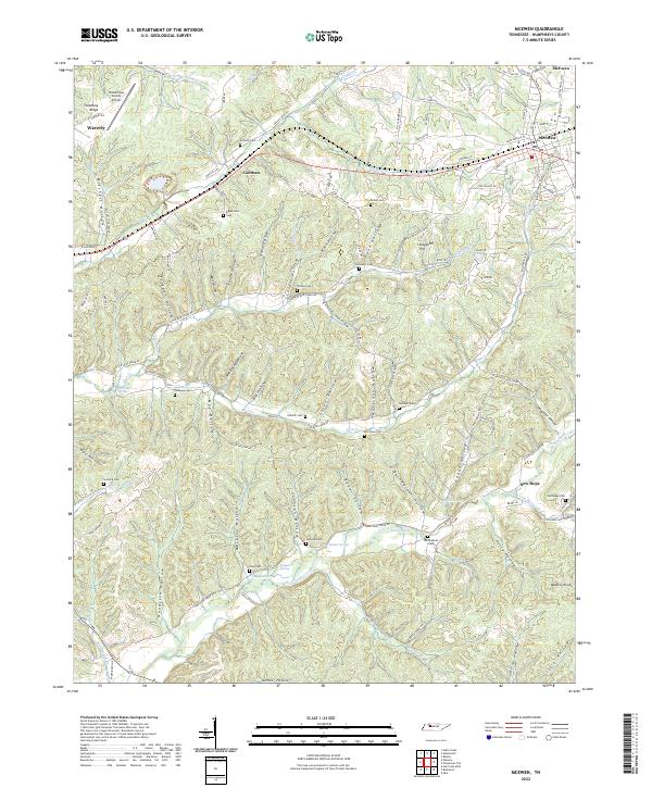
McEwen and Gorman anchor the high ground in eastern Humphreys County, where the CSX Transportation line follows the natural corridor of Trace Cr. This landscape is defined by an intricate network of hollows, such as Trogden Hollow, Goodrich Hollow, and Mullina x Hollow, which feed into larger watercourses like Hurricane Creek. The distribution of family burial grounds, including Seifarth Cem, Bennyfield Cem, and McCandless Cem, indicates long-standing land tenure patterns throughout the dissected plateau. In the northwest corner, the Humphreys County Airport sits on Stephany Ridge, representing a modern infrastructure footprint atop the traditional topography. Numerous springs, such as Simpson Spring and Shiloh Spring, underscore the importance of natural water sources for the rural communities of New Hope and surrounding settlements.
Find a feature on this map
124 named features on this map. Tap any name to fly to it.
Don’t see what you’re looking for? This feature index may not catch every label — zoom into the map to look around manually.
Map Details
Editions of this 2022 McEwen Map
This is the sole edition of this map. No revisions or reprints were ever made.
Historical Maps of Forks of Blue Creek Through Time
1 maps found