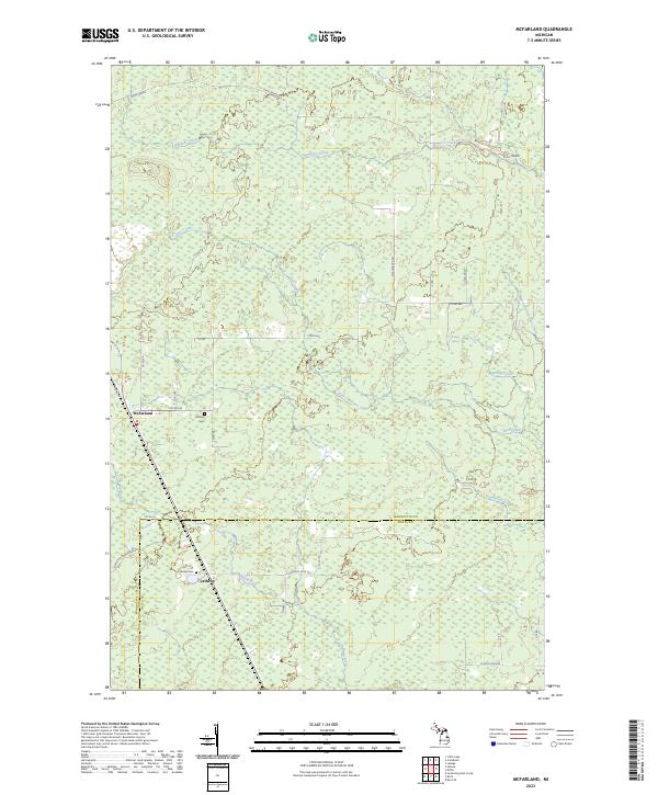
2023 Map of McFarland
USGS Topo · Published 2023About this map
Lathrop and McFarland anchor this landscape along the border of Marquette and Delta counties, where the Rapid River and Deer Creek dominate the local drainage. The map reveals a history of movement and early settlement through several distinct labels, including the Stack Grade, which suggests the legacy of former rail or logging infrastructure. Local genealogy is supported by the inclusion of Hillview Cem near McFarland and Lathrop Cem further south. The terrain is crisscrossed by numerous local routes like Hamilton Homestead Rd, Co Rd 444, and Maple Grove Rd, indicating a sparse but established network of homesteads and camps. Distinctive natural landmarks such as Boiling Spring and the aptly named Deadhorse Creek provide unique geographic markers in this northern forest and wetland environment.
Find a feature on this map
37 named features on this map. Tap any name to fly to it.
Don’t see what you’re looking for? This feature index may not catch every label — zoom into the map to look around manually.
Map Details
Editions of this 2023 McFarland Map
This is the sole edition of this map. No revisions or reprints were ever made.
Other maps of this area

1932 · Skandia SW
USGS Topo · 1:31,680

1932 · Rock SW
USGS Topo · 1:31,680

1932 · Helena NE
USGS Topo · 1:31,680

1932 · Rock NE
USGS Topo · 1:31,680

1932 · Skandia SE
USGS Topo · 1:31,680

1932 · Rock SE
USGS Topo · 1:31,680

1932 · Harvey SE
USGS Topo · 1:31,680

1932 · Rock NW
USGS Topo · 1:31,680

1932 · Helena
USGS Topo · 1:31,680

1951 · Helena
USGS Topo · 1:31,680