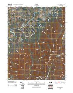
2010 Map of McGaheysville
USGS Topo · Published 2010About this map
The South Fork Shenandoah River winds through the western valley near McGaheysville, where long-standing settlements like Island Ford and Berrytown sit below the rising eastern ridges. This 2010 survey captures the convergence of the river valley's agricultural landscape with the protected wilderness of Shenandoah National Park. Steep terrain features like Rocky Mountain and Loft Mountain dominate the eastern half of the map, segmented by the iconic Skyline Dr and the Appalachian Trl. For researchers, the map provides precise locations for mountain infrastructure including the Doyles River Cabin and Big Run Shelter. The transition from the valley floor, marked by the Mount Olivet Cemetery, to the high overlooks like Rockytop Overlook illustrates the dramatic elevation shifts that define the local geography in Rockingham County.
Find a feature on this map
61 named features on this map. Tap any name to fly to it.
Don’t see what you’re looking for? This feature index may not catch every label — zoom into the map to look around manually.
Map Details
Editions of this 2010 McGaheysville Map
This is the sole edition of this map. No revisions or reprints were ever made.
Other maps of this area

1892 · Harrisonburg
USGS Topo · 1:125,000

1931 · University
USGS Topo · 1:62,500

1934 · Waynesboro
USGS Topo · 1:48,000

1935 · University
USGS Topo · 1:62,500

1937 · Elkton
USGS Topo · 1:62,500

1939 · Waynesboro
USGS Topo · 1:62,500

1941 · Harrisonburg
USGS Topo · 1:62,500

1943 · Harrisonburg
USGS Topo · 1:62,500

1949 · Charlottesville
USGS Topo · 1:250,000

1956 · Charlottesville
USGS Topo · 1:250,000