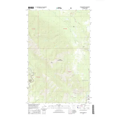
2017 Map of McGee Meadow
USGS Topo · Published 2017About this map
McGee Meadow and the high ridges of the Apgar Mountains dominate this 2017 landscape within Glacier National Park. The survey details a network of drainage systems, where Fish Cr, Fern Cr, and McGee Cr descend through steep topography toward the North Fork Flathead River. This area serves as a transition from the lower elevations near West Glacier to high observation points like Huckleberry Lookout and Apgar Lookout.
Find a feature on this map
27 named features on this map. Tap any name to fly to it.
Don’t see what you’re looking for? This feature index may not catch every label — zoom into the map to look around manually.
Map Details
Editions of this 2017 McGee Meadow Map
This is the sole edition of this map. No revisions or reprints were ever made.
Other maps of this area
1904 · Chief Mountain
USGS Topo · 1:125,000
1906 · Kintla Lakes
USGS Topo · 1:125,000
1914 · Nyack
USGS Topo · 1:125,000
1938 · Chief Mountain
USGS Topo · 1:125,000
1938 · Kintla Lakes
USGS Topo · 1:125,000
1943 · Kalispell
USGS Topo · 1:125,000

1957 · Kalispell
USGS Topo · 1:250,000

1960 · Kalispell
USGS Topo · 1:250,000
1960 · Cut Bank
USGS Topo · 1:250,000

1961 · Kalispell
USGS Topo · 1:250,000