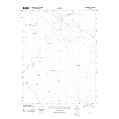
2012 Map of McGuire Ridge
USGS Topo · Published 2012About this map
Old Red Rock Place and several family-named ranching outposts define this stretch of the California Coast Ranges in the early 21st century. The map illustrates a landscape carved by the N Fork Gualala River and the S Fork Gualala River, where ridge-top roads like Fish Rock Rd and Zeni Ridge Rd provide the primary access to remote holdings. Genealogists and local historians will find several established ranches, including Zeni Ranch, Gianoli Ranch, and Ciapusci Ranch, alongside legacy locations like Tindall Camp. Topographic details such as the Jackknife Tunnel and Jackknife Turn near McKenzie Grade suggest the engineering challenges of navigating this terrain. The map also identifies specific clearings and geographic markers like Lowrey Openings, Peachtree Flat, and Little Red Rock Mountain, offering a precise record of land use and naming conventions in this corner of Mendocino County.
Find a feature on this map
44 named features on this map. Tap any name to fly to it.
Don’t see what you’re looking for? This feature index may not catch every label — zoom into the map to look around manually.
Map Details
Editions of this 2012 McGuire Ridge Map
This is the sole edition of this map. No revisions or reprints were ever made.
Other maps of this area

1921 · Plantation
USGS Topo · 1:62,500

1943 · Point Arena
USGS Topo · 1:62,500

1943 · Stewarts Point
USGS Topo · 1:24,000

1943 · Annapolis
USGS Topo · 1:24,000

1943 · Ornbaun
USGS Topo · 1:62,500

1944 · Annapolis
USGS Topo · 1:31,680

1944 · Stewarts Point
USGS Topo · 1:31,680

1944 · Ornbaun
USGS Topo · 1:62,500

1947 · Santa Rosa
USGS Topo · 1:250,000

1949 · Santa Rosa
USGS Topo · 1:250,000