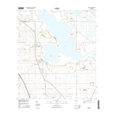
2015 Map of McIntosh
USGS Topo · Published 2015About this map
McIntosh and the surrounding North Central Florida landscape are defined by the sprawling waters of Orange Lake, which straddles the boundary between Alachua and Marion counties. This modern topographic survey illustrates a rural environment where agriculture and aviation meet, featuring specialized landing strips like Rimes Lakecrest Airport and the colorfully named Thompson's Goinbroke Aero Ranch. The settlement patterns follow the corridor between Evinston and Reddick, with several small communities and older burying grounds such as Millwood Cem and Center Hill Cem marking the historical footprint of the area.
Find a feature on this map
98 named features on this map. Tap any name to fly to it.
Don’t see what you’re looking for? This feature index may not catch every label — zoom into the map to look around manually.
Map Details
Editions of this 2015 McIntosh Map
This is the sole edition of this map. No revisions or reprints were ever made.
Other maps of this area

1890 · Arredondo
USGS Topo · 1:62,500

1892 · Arredondo
USGS Topo · 1:62,500

1893 · Citra
USGS Topo · 1:62,500

1894 · Arredondo
USGS Topo · 1:62,500

1895 · Williston
USGS Topo · 1:62,500

1895 · Citra
USGS Topo · 1:62,500

1938 · Hawthorn
USGS Topo · 1:48,000

1943 · Hawthorn
USGS Topo · 1:62,500

1954 · Gainesville
USGS Topo · 1:250,000

1958 · Gainesville
USGS Topo · 1:250,000