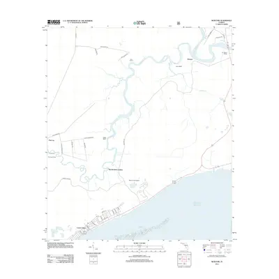
2012 Map of McIntyre
USGS Topo · Published 2012About this map
The winding Crooked River and Ochlockonee River dominate this coastal landscape, creating a complex network of wetlands and river bends before meeting the Gulf of Mexico. On the southern edge, the residential grid of Lanark Village contrasts with the surrounding natural terrain of Saint James Island. Small, dispersed settlements like McIntyre and Pine Log are connected by rural routes such as McIntyre Rd and Jeff Sanders Rd.
Find a feature on this map
41 named features on this map. Tap any name to fly to it.
Don’t see what you’re looking for? This feature index may not catch every label — zoom into the map to look around manually.
Map Details
Editions of this 2012 McIntyre Map
This is the sole edition of this map. No revisions or reprints were ever made.
Other maps of this area

1940 · Arran
USGS Topo · 1:62,500

1943 · Arran
USGS Topo · 1:62,500

1943 · Dog Island
USGS Topo · 1:31,680

1943 · Carrabelle
USGS Topo · 1:24,000

1943 · St. Teresa Beach
USGS Topo · 1:24,000

1944 · Pickett Bay
USGS Topo · 1:31,680

1944 · Carrabelle
USGS Topo · 1:31,680

1945 · Thousand Yard Bay
USGS Topo · 1:31,680

1945 · Mc Intyre
USGS Topo · 1:31,680

1945 · St Teresa
USGS Topo · 1:31,680