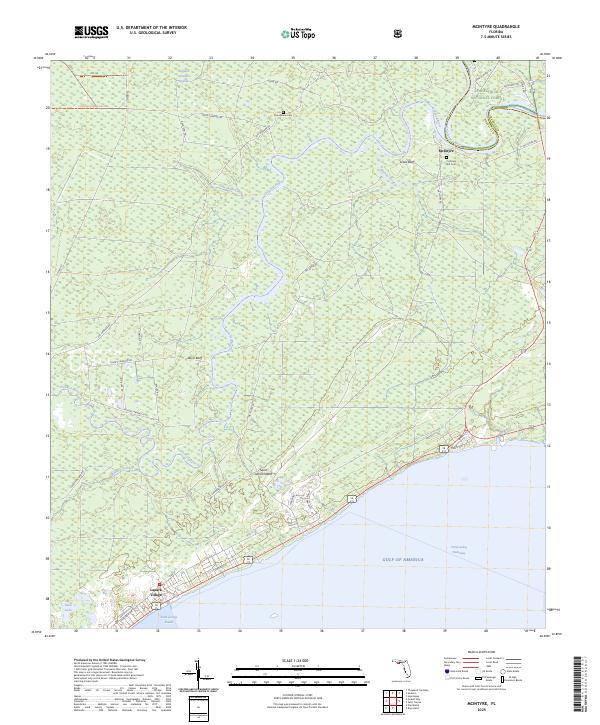
2025 Map of McIntyre
USGS Topo · Published 2025About this map
The Ochlockonee River flows through the heart of this coastal landscape, defining the boundary between the Apalachicola National Forest and the dense wetlands of the Womack Creek Swamp. This area is characterized by an intricate drainage network where the Crooked River meanders toward the Saint George Sound, creating a complex of bluffs and lowlands. Near the river junction lies McIntyre, while further south, the planned layout of Lanark Village sits along the shoreline of the Gulf of America. Local history is anchored by family-named sites such as Thompsons Cem and Cochrans Still Cem, which point to early pioneer and turpentine industry roots in the Florida Panhandle. Significant terrain features like Lewis Bluff and Davis Bluff break the coastal flatlands, while the Intracoastal Waterway highlights the region's importance for maritime navigation.
Find a feature on this map
45 named features on this map. Tap any name to fly to it.
Don’t see what you’re looking for? This feature index may not catch every label — zoom into the map to look around manually.
Map Details
Editions of this 2025 McIntyre Map
This is the sole edition of this map. No revisions or reprints were ever made.
Other maps of this area

1940 · Arran
USGS Topo · 1:62,500

1943 · Arran
USGS Topo · 1:62,500

1943 · Dog Island
USGS Topo · 1:31,680

1943 · Carrabelle
USGS Topo · 1:24,000

1943 · St. Teresa Beach
USGS Topo · 1:24,000

1944 · Pickett Bay
USGS Topo · 1:31,680

1944 · Carrabelle
USGS Topo · 1:31,680

1945 · Thousand Yard Bay
USGS Topo · 1:31,680

1945 · Mc Intyre
USGS Topo · 1:31,680

1945 · St Teresa
USGS Topo · 1:31,680