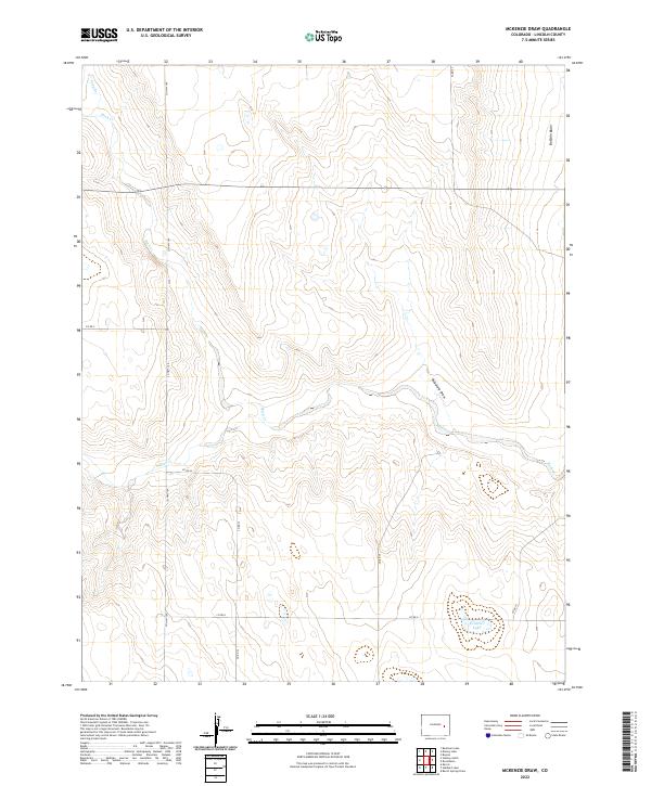
2022 Map of McKenzie Draw
USGS Topo · Published 2022About this map
Rush Cr and its tributary S Rush Cr define the drainage of this high plains landscape in Lincoln County. The terrain is characterized by broad depressions and intermittent watercourses, notably Buffalo Basin in the northeast and the eponymous McKenzie Draw which carves a path through the central sections. This modern survey illustrates the expansive grid of the Public Land Survey System, with township and range lines like t14s r54w superimposed over the natural topography. Settlement in this arid region is sparse, marked by a network of county roads such as Co HWY 109 and Co RD 33. In the southeastern corner, the isolated Evilsizer Lake provides a rare perennial water feature in an otherwise dry, channeled environment.
Find a feature on this map
22 named features on this map. Tap any name to fly to it.
Don’t see what you’re looking for? This feature index may not catch every label — zoom into the map to look around manually.
Map Details
Editions of this 2022 McKenzie Draw Map
This is the sole edition of this map. No revisions or reprints were ever made.
Other maps of this area

1889 · Sanborn
USGS Topo · 1:125,000

1891 · Sanborn
USGS Topo · 1:125,000

1891 · Arroyo
USGS Topo · 1:125,000

1893 · Arroyo
USGS Topo · 1:125,000

1893 · Sanborn
USGS Topo · 1:125,000

1954 · Lamar
USGS Topo · 1:250,000

1958 · Lamar
USGS Topo · 1:250,000

1975 · Stanley Gulch
USGS Topo · 1:24,000
1978 · Beckman Lake
USGS Topo · 1:24,000
1978 · Kinney Lake
USGS Topo · 1:24,000