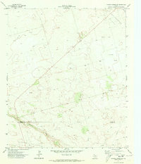
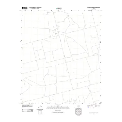
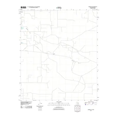
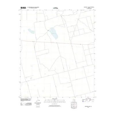
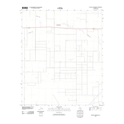
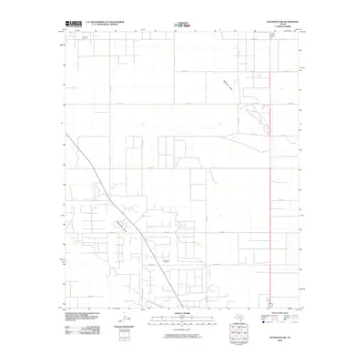
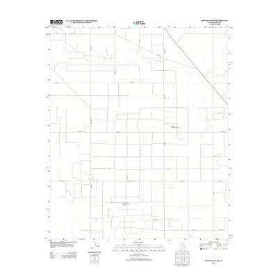
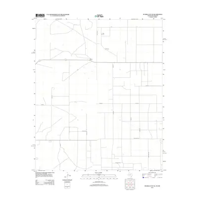
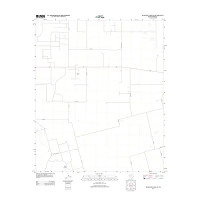
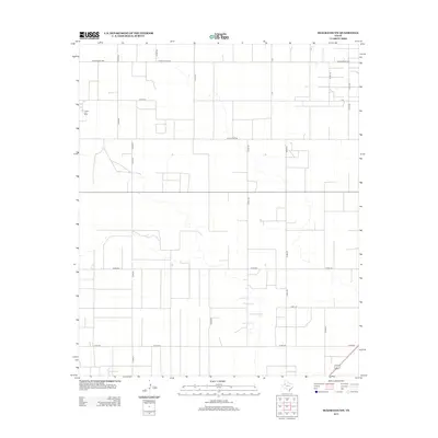
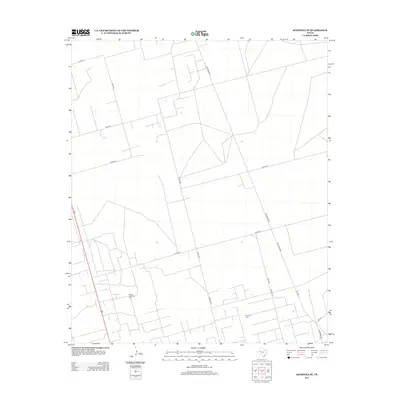
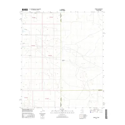
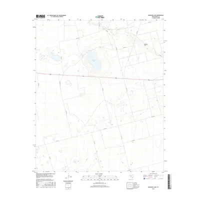
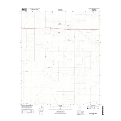
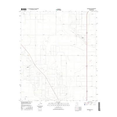
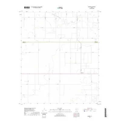
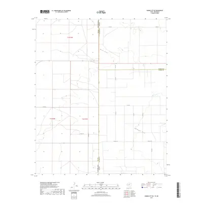
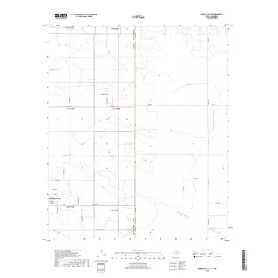
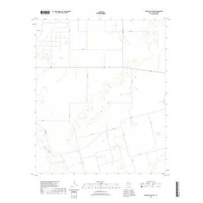
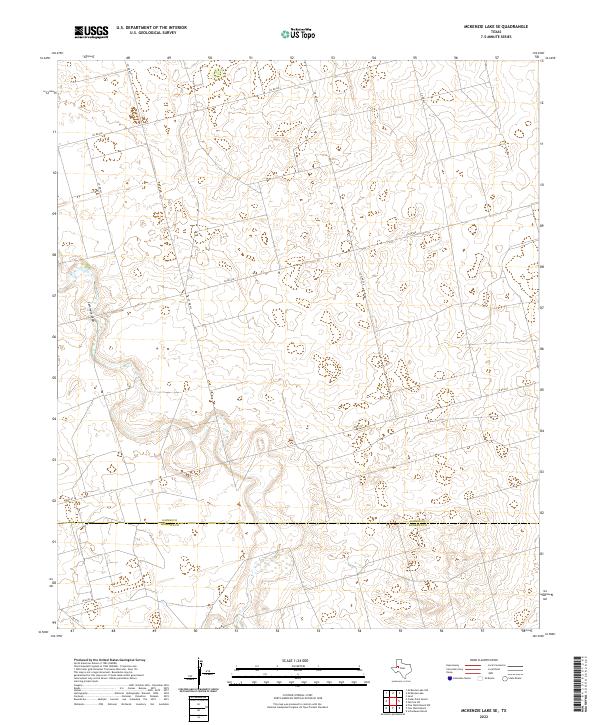
1970 Map of McKenzie Lake SE
USGS Topo · Published 1973About this map
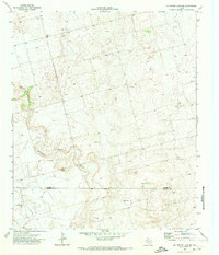
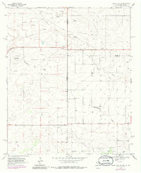
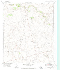
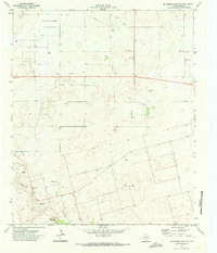
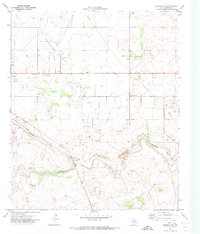
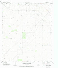
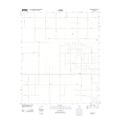
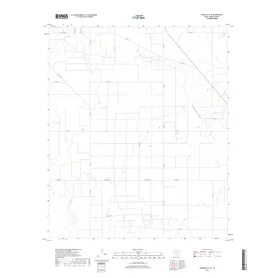
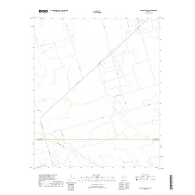
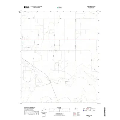
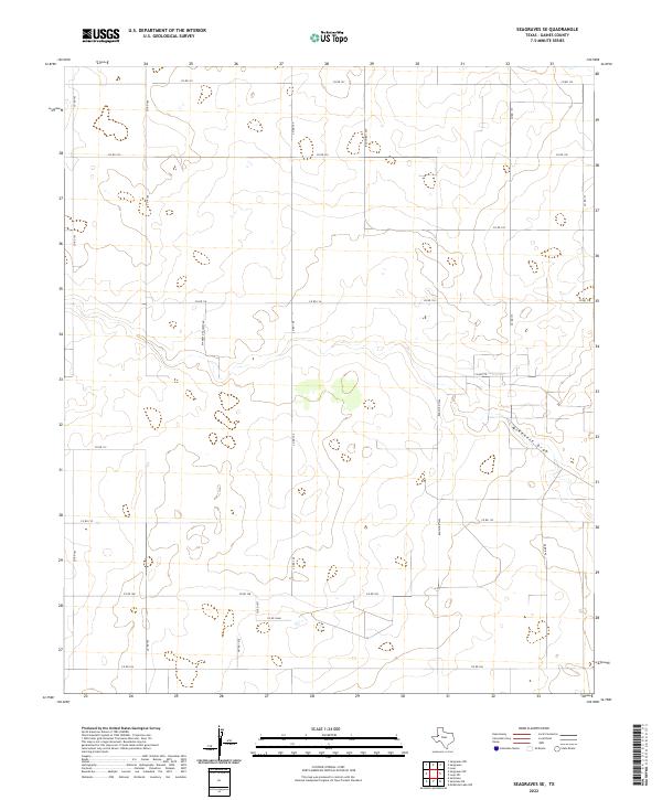
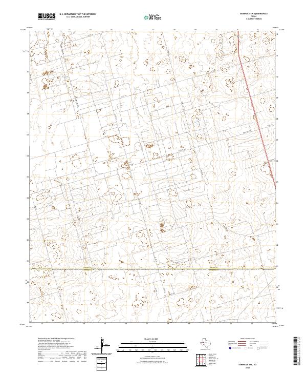
The Glasco Oil Field dominates the southern landscape of this West Texas terrain, where the border between Gaines Co and Andrews Co meets an intensive network of petroleum extraction. Documented in 1970, the area is defined by a dense grid of Oil Wells and numerous Drill Holes, showing the mid-century expansion of the Permian Basin's energy infrastructure. The Pipeline corridors and the Florey Pumping Sta indicate the complex logistics required to move resources from these semi-arid plains. Cutting through the center of the sheet, the winding path of Seminole Draw provides the primary topographic relief, creating a natural drainage pattern that contrasts with the geometric precision of the industrial sites and scattered Water Tanks.
Find a feature on this map
11 named features on this map. Tap any name to fly to it.
Don’t see what you’re looking for? This feature index may not catch every label — zoom into the map to look around manually.
Map Details
Editions of this 1970 McKenzie Lake SE Map
This is the sole edition of this map. No revisions or reprints were ever made.
Historical Maps of Gaines County Through Time
140 maps found
1969 Ashmore
Gaines County, TX
1969 Hobbs East
Gaines County, TX
1969 Hobbs SE
Gaines County, TX
1969 Humble City NE
Gaines County, TX
1969 Humble City SE
Gaines County, TX
1969 Seminole SW
Gaines County, TX
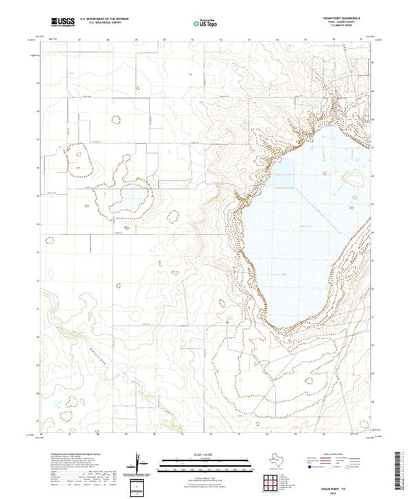
1970 Cedar Point
Gaines County, TX
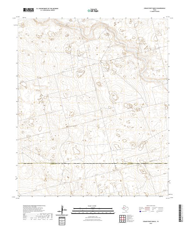
1970 Cedar Point Ranch
Gaines County, TX
1970 Humble City SE
Gaines County, TX
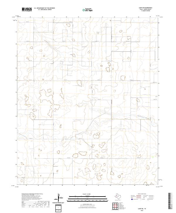
1970 Loop SW
Gaines County, TX
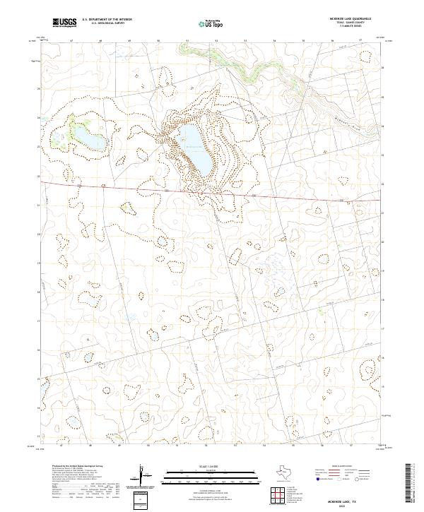
1970 McKenzie Lake
Gaines County, TX
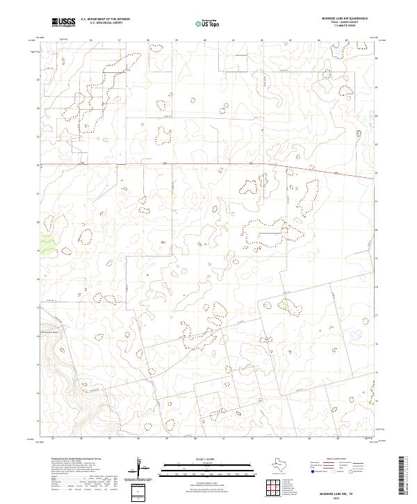
1970 McKenzie Lake NW
Gaines County, TX
1970 McKenzie Lake SE
Gaines County, TX
1970 Seagraves NW
Gaines County, TX
1970 Seagraves SE
Gaines County, TX
1970 Seagraves SW
Gaines County, TX
1970 Seminole NE
Gaines County, TX
1970 Seminole SE
Gaines County, TX
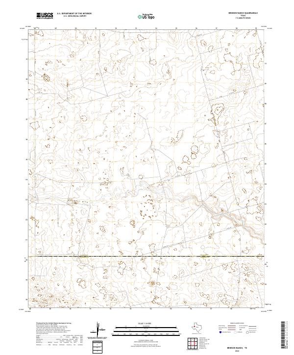
1971 Brinson Ranch
Gaines County, TX
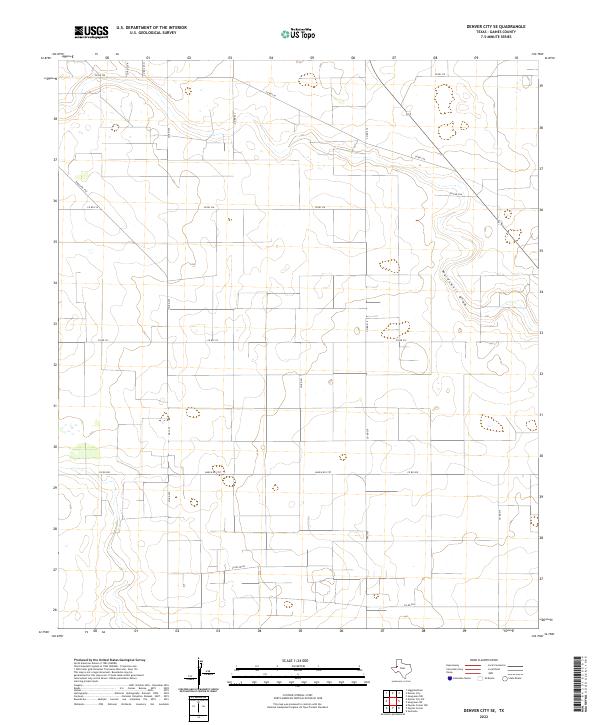
1971 Denver City SE
Gaines County, TX
1971 Denver City SW
Gaines County, TX
1971 Higginbotham
Gaines County, TX
1971 Paynes Corner
Gaines County, TX
1971 Paynes Corner NW
Gaines County, TX
1971 Paynes Corner SE
Gaines County, TX
2010 Ashmore
Gaines County, TX
2010 Brinson Ranch
Gaines County, TX
2010 Cedar Point
Gaines County, TX
2010 Cedar Point Ranch
Gaines County, TX
2010 Denver City SE
Gaines County, TX
2010 Denver City SW
Gaines County, TX
2010 Higginbotham
Gaines County, TX
2010 Hobbs SE
Gaines County, TX
2010 Humble City NE
Gaines County, TX
2010 Humble City SE
Gaines County, TX
2010 Loop SW
Gaines County, TX
2010 McKenzie Lake
Gaines County, TX
2010 McKenzie Lake NW
Gaines County, TX
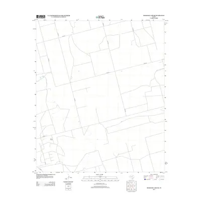
2010 McKenzie Lake SE
Gaines County, TX
2010 Paynes Corner
Gaines County, TX
2010 Paynes Corner NW
Gaines County, TX
2010 Paynes Corner SE
Gaines County, TX
2010 Seagraves NW
Gaines County, TX
2010 Seagraves SE
Gaines County, TX
2010 Seagraves SW
Gaines County, TX
2010 Seminole NE
Gaines County, TX
2010 Seminole SE
Gaines County, TX
2010 Seminole SW
Gaines County, TX
2012 Ashmore
Gaines County, TX
2012 Brinson Ranch
Gaines County, TX
2012 Cedar Point
Gaines County, TX
2012 Cedar Point Ranch
Gaines County, TX
2012 Denver City SE
Gaines County, TX
2012 Denver City SW
Gaines County, TX
2012 Higginbotham
Gaines County, TX
2012 Hobbs SE
Gaines County, TX
2012 Humble City NE
Gaines County, TX
2012 Humble City SE
Gaines County, TX
2012 Loop SW
Gaines County, TX
2012 McKenzie Lake
Gaines County, TX
2012 McKenzie Lake NW
Gaines County, TX
2012 McKenzie Lake SE
Gaines County, TX

2012 Paynes Corner
Gaines County, TX
2012 Paynes Corner NW
Gaines County, TX
2012 Paynes Corner SE
Gaines County, TX
2012 Seagraves NW
Gaines County, TX
2012 Seagraves SE
Gaines County, TX
2012 Seagraves SW
Gaines County, TX
2012 Seminole NE
Gaines County, TX
2012 Seminole SE
Gaines County, TX
2012 Seminole SW
Gaines County, TX
2016 Ashmore
Gaines County, TX

2016 Brinson Ranch
Gaines County, TX
2016 Cedar Point
Gaines County, TX
2016 Cedar Point Ranch
Gaines County, TX
2016 Denver City SE
Gaines County, TX
2016 Denver City SW
Gaines County, TX
2016 Higginbotham
Gaines County, TX
2016 Hobbs SE
Gaines County, TX
2016 Humble City NE
Gaines County, TX
2016 Humble City SE
Gaines County, TX
2016 Loop SW
Gaines County, TX
2016 McKenzie Lake
Gaines County, TX
2016 McKenzie Lake NW
Gaines County, TX
2016 McKenzie Lake SE
Gaines County, TX
2016 Paynes Corner
Gaines County, TX
2016 Paynes Corner NW
Gaines County, TX
2016 Paynes Corner SE
Gaines County, TX
2016 Seagraves NW
Gaines County, TX
2016 Seagraves SE
Gaines County, TX
2016 Seagraves SW
Gaines County, TX
2016 Seminole NE
Gaines County, TX
2016 Seminole SE
Gaines County, TX
2016 Seminole SW
Gaines County, TX
2019 Ashmore
Gaines County, TX
2019 Brinson Ranch
Gaines County, TX
2019 Cedar Point
Gaines County, TX
2019 Cedar Point Ranch
Gaines County, TX
2019 Denver City SE
Gaines County, TX
2019 Denver City SW
Gaines County, TX
2019 Higginbotham
Gaines County, TX
2019 Hobbs SE
Gaines County, TX
2019 Humble City NE
Gaines County, TX
2019 Humble City SE
Gaines County, TX
2019 Loop SW
Gaines County, TX
2019 McKenzie Lake
Gaines County, TX
2019 McKenzie Lake NW
Gaines County, TX
2019 McKenzie Lake SE
Gaines County, TX
2019 Paynes Corner
Gaines County, TX
2019 Paynes Corner NW
Gaines County, TX
2019 Paynes Corner SE
Gaines County, TX
2019 Seagraves NW
Gaines County, TX
2019 Seagraves SE
Gaines County, TX
2019 Seagraves SW
Gaines County, TX
2019 Seminole NE
Gaines County, TX
2019 Seminole SE
Gaines County, TX
2019 Seminole SW
Gaines County, TX
2022 Ashmore
Gaines County, TX
2022 Brinson Ranch
Gaines County, TX
2022 Cedar Point
Gaines County, TX
2022 Cedar Point Ranch
Gaines County, TX
2022 Denver City SE
Gaines County, TX
2022 Denver City SW
Gaines County, TX
2022 Higginbotham
Gaines County, TX
2022 Hobbs SE
Gaines County, TX
2022 Humble City NE
Gaines County, TX

2022 Humble City SE
Gaines County, TX
2022 Loop SW
Gaines County, TX
2022 McKenzie Lake
Gaines County, TX
2022 McKenzie Lake NW
Gaines County, TX
2022 McKenzie Lake SE
Gaines County, TX
2022 Paynes Corner
Gaines County, TX
2022 Paynes Corner NW
Gaines County, TX
2022 Paynes Corner SE
Gaines County, TX
2022 Seagraves NW
Gaines County, TX
2022 Seagraves SE
Gaines County, TX
2022 Seagraves SW
Gaines County, TX
2022 Seminole NE
Gaines County, TX
2022 Seminole SE
Gaines County, TX
2022 Seminole SW
Gaines County, TX