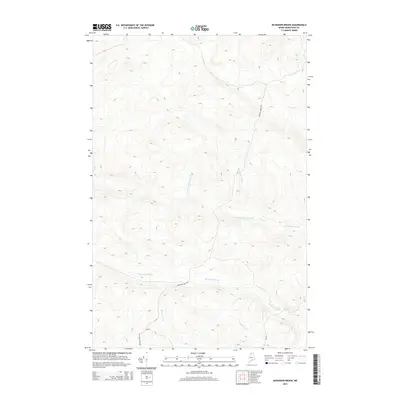
2014 Map of McKinnon Brook
USGS Topo · Published 2014About this map
McKinnon Brook flows through this remote section of northern Aroostook County, defining a landscape dominated by the intricate hydrology of the Maine woods. The drainage patterns are clearly marked by several major tributaries, including the W Br Ben Glazier Brook, Ben Glazier Brook, and Savage Brook, which carve through the densely contoured terrain. Human presence is limited to narrow corridors like Michaud Farm Rd and the short stretch of Inn Rd, which provide the primary access through the timberlands. The convergence of Bogan Brook into the larger stream network highlights the seasonal wetland characteristics of the region, where topographic elevation changes rapidly away from the watercourses. This map documents the area during the early twenty-first century, showing the established network of logging roads and natural waterways that have shaped local industry for generations.
Find a feature on this map
7 named features on this map. Tap any name to fly to it.
Don’t see what you’re looking for? This feature index may not catch every label — zoom into the map to look around manually.
Map Details
Editions of this 2014 McKinnon Brook Map
This is the sole edition of this map. No revisions or reprints were ever made.
Other maps of this area

1930 · Allagash
USGS Topo · 1:48,000

1932 · Allagash Falls
USGS Topo · 1:48,000

1933 · Allagash
USGS Topo · 1:62,500

1935 · Allagash Falls
USGS Topo · 1:62,500

1954 · Presque Isle
USGS Topo · 1:250,000

1955 · Rocky Mountain
USGS Topo · 1:62,500

1955 · Round Pond
USGS Topo · 1:62,500

1956 · Allagash Falls
USGS Topo · 1:50,000

1958 · Presque Isle
USGS Topo · 1:250,000

1960 · Presque Isle
USGS Topo · 1:250,000