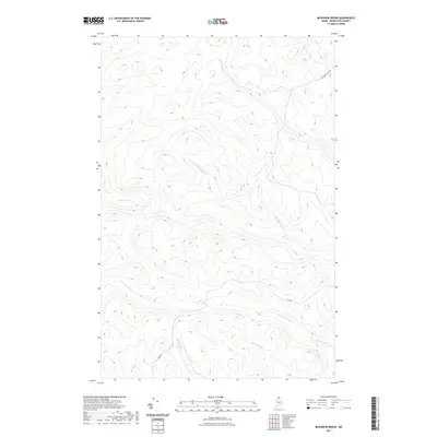
2021 Map of McKinnon Brook
USGS Topo · Published 2021About this map
McKinnon Brook and its various tributaries define the interior landscape of this timberland region in northern Maine. The map reveals the intricate drainage patterns of the Aroostook County woods, where Ben Glazier Brook and the W Br Ben Glazier Brook cut through the high-elevation terrain. This area, largely devoid of permanent settlements, is instead crisscrossed by historic utility routes such as the Michaud Tote Rd. These "tote roads" were traditionally used by loggers to haul supplies to remote camps, reflecting the long-standing industrial heritage of the North Maine Woods. Other water features like Stewart Brook, Savage Brook, and Bogan Brook mark the low-lying wetlands between ridges, while the presence of the Inn Rd suggests localized access points within the vast forest network managed by the state and private interests.
Find a feature on this map
8 named features on this map. Tap any name to fly to it.
Don’t see what you’re looking for? This feature index may not catch every label — zoom into the map to look around manually.
Map Details
Editions of this 2021 McKinnon Brook Map
This is the sole edition of this map. No revisions or reprints were ever made.
Other maps of this area

1930 · Allagash
USGS Topo · 1:48,000

1932 · Allagash Falls
USGS Topo · 1:48,000

1933 · Allagash
USGS Topo · 1:62,500

1935 · Allagash Falls
USGS Topo · 1:62,500

1954 · Presque Isle
USGS Topo · 1:250,000

1955 · Rocky Mountain
USGS Topo · 1:62,500

1955 · Round Pond
USGS Topo · 1:62,500

1956 · Allagash Falls
USGS Topo · 1:50,000

1958 · Presque Isle
USGS Topo · 1:250,000

1960 · Presque Isle
USGS Topo · 1:250,000