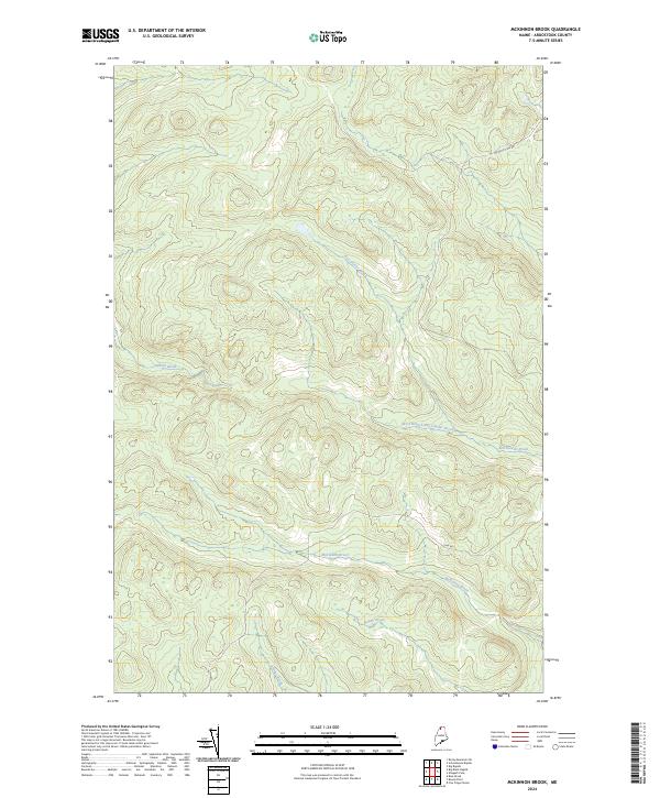
2024 Map of McKinnon Brook
USGS Topo · Published 2024About this map
McKinnon Brook and its complex network of tributaries define this pocket of the North Maine Woods, where the landscape is carved by a dense hydrological system. This contemporary survey reveals a wilderness terrain largely devoid of permanent settlements, focused instead on the seasonal access provided by traditional routes like the Michaud Tote Rd and Inn Rd. These roads suggest a landscape primarily used for timber harvesting and remote recreation, where the naming of Stewart Brook and Ben Glazier Brook points toward the early woodsmen and settlers who first traversed these drainages. The inclusion of the West Branch Ben Glazier Brook and Bogan Brook provides a detailed view of the watershed patterns that have long dictated movement through this interior section of Aroostook County.
Find a feature on this map
8 named features on this map. Tap any name to fly to it.
Don’t see what you’re looking for? This feature index may not catch every label — zoom into the map to look around manually.
Map Details
Editions of this 2024 McKinnon Brook Map
This is the sole edition of this map. No revisions or reprints were ever made.
Other maps of this area

1930 · Allagash
USGS Topo · 1:48,000

1932 · Allagash Falls
USGS Topo · 1:48,000

1933 · Allagash
USGS Topo · 1:62,500

1935 · Allagash Falls
USGS Topo · 1:62,500

1954 · Presque Isle
USGS Topo · 1:250,000

1955 · Rocky Mountain
USGS Topo · 1:62,500

1955 · Round Pond
USGS Topo · 1:62,500

1956 · Allagash Falls
USGS Topo · 1:50,000

1958 · Presque Isle
USGS Topo · 1:250,000

1960 · Presque Isle
USGS Topo · 1:250,000