
1936 Map of McKinnon
USGS Topo · Published 1936About this map
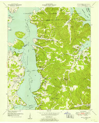
The Tennessee River corridor in Middle Tennessee is captured here as a critical transportation artery during the mid-1930s. The presence of the Danville Ferry and the Danville River Terminal highlights a landscape where water and rail connectivity converged, particularly where the Louisville and Nashville Railroad crosses the river. This era shows the rural infrastructure of Houston, Stewart, and Benton Counties before major Tennessee Valley Authority projects would later alter the river's shoreline. Numerous small landings like Youngs Landing and Stagner Landing dot the riverbanks, serving as local collection points for river traffic. Inland, the map reveals a dense network of community landmarks including Days Chapel, Fairfield Sch, and family-named cemeteries such as Gomer Hill Cem. The terrain is deeply incised by the drainage of Cane Creek and Hurricane Creek, with named crossings like Douglas Ford providing essential transit through the hollows.
Find a feature on this map
59 named features on this map. Tap any name to fly to it.
Don’t see what you’re looking for? This feature index may not catch every label — zoom into the map to look around manually.
Map Details
Editions of this 1936 McKinnon Map
This is the sole edition of this map. No revisions or reprints were ever made.
Other maps of this area

1936 · Poplar Creek
USGS Topo · 1:24,000

1936 · Big Sandy
USGS Topo · 1:24,000

1936 · Stewart
USGS Topo · 1:24,000

1936 · Centerville Landing
USGS Topo · 1:24,000

1936 · Halls Creek
USGS Topo · 1:24,000

1936 · Harmon Creek
USGS Topo · 1:24,000

1936 · Standing Rock
USGS Topo · 1:24,000

1936 · Dover
USGS Topo · 1:24,000

1949 · Harmon Creek
USGS Topo · 1:24,000
1949 · Poplar Creek
USGS Topo · 1:24,000