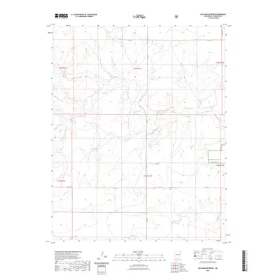
2023 Map of McLaughlin Bridge
USGS Topo · Published 2023About this map
Kiowa National Grassland defines the eastern portion of this high plains landscape, where the drainage systems of Corrumpa Creek and Alamosita Creek carve through the terrain. The map captures a transition between protected public lands and private ranching territory, structured by a network of county roads including Lake Rd and Kear Rd. Evidence of early settlement persists in the presence of Grandview Cem, a vital waypoint for genealogists tracing family roots in this sparsely populated section of Union County. The hydrology of the region is further marked by Rafael Creek and Alamos Creek, which provide a clear picture of the natural water distribution across the township and range grids. This survey reflects the modern management of these ancestral grazing lands, documenting the enduring rural infrastructure that connects isolated homesteads to the wider county network.
Find a feature on this map
19 named features on this map. Tap any name to fly to it.
Don’t see what you’re looking for? This feature index may not catch every label — zoom into the map to look around manually.
Map Details
Editions of this 2023 McLaughlin Bridge Map
This is the sole edition of this map. No revisions or reprints were ever made.
Other maps of this area

1954 · Dalhart
USGS Topo · 1:250,000

1958 · Dalhart
USGS Topo · 1:250,000

1962 · Dalhart
USGS Topo · 1:250,000

1972 · Seneca
USGS Topo · 1:24,000

1972 · Mc Laughlin Bridge
USGS Topo · 1:24,000

1972 · Mount Dora
USGS Topo · 1:24,000

1972 · Bible Top Butte
USGS Topo · 1:24,000
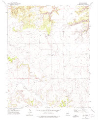
1972 · Guy
USGS Topo · 1:24,000

1972 · Cuates School
USGS Topo · 1:24,000

1972 · Atencio
USGS Topo · 1:24,000