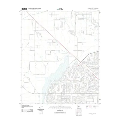
2011 Map of McMicken Dam
USGS Topo · Published 2011About this map
McMicken Dam and the expansive Trilby Wash Basin dominate this landscape in Maricopa County, illustrating the critical infrastructure designed to manage desert water flow. The settlement of Beardsley sits at the intersection of suburban expansion and industrial utility, with dense residential street grids like W Bell Rd and W Reems Rd pushing north toward the flood control structures.
Find a feature on this map
44 named features on this map. Tap any name to fly to it.
Don’t see what you’re looking for? This feature index may not catch every label — zoom into the map to look around manually.
Map Details
Editions of this 2011 McMicken Dam Map
This is the sole edition of this map. No revisions or reprints were ever made.
Other maps of this area

1954 · Phoenix
USGS Topo · 1:250,000

1957 · Phoenix
USGS Topo · 1:250,000

1957 · White Tank Mts. SE
USGS Topo · 1:24,000

1957 · White Tank Mts. NE
USGS Topo · 1:24,000

1957 · Calderwood Butte
USGS Topo · 1:24,000

1957 · McMicken Dam
USGS Topo · 1:24,000

1957 · El Mirage
USGS Topo · 1:24,000

1957 · Waddell
USGS Topo · 1:24,000

1957 · White Tank Mts.
USGS Topo · 1:62,500

1958 · Phoenix
USGS Topo · 1:250,000