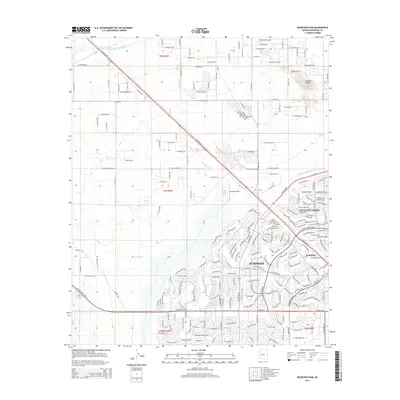
2014 Map of McMicken Dam
USGS Topo · Published 2014About this map
Surprise and Sun City West anchor this 2014 survey of the desert landscape west of Phoenix, revealing the intensive suburban development and water management infrastructure essential to the region's growth. The massive McMicken Dam and its associated Trilby Wash Basin dominate the central terrain, designed to manage seasonal runoff from the surrounding hills. This water control system is complemented by the Central Arizona Project Aqueduct, which cuts diagonally across the northwest, and the Beardsley Canal winding through the south. The map documents a moment of transition where established grid-patterned agricultural and desert lands meet the intricate cul-de-sac networks of modern residential communities. Local landmarks like Bunker Peak and the community of Beardsley provide geographic context for researchers tracing the rapid physical changes in Maricopa County during the early 21st century.
Find a feature on this map
104 named features on this map. Tap any name to fly to it.
Don’t see what you’re looking for? This feature index may not catch every label — zoom into the map to look around manually.
Map Details
Editions of this 2014 McMicken Dam Map
This is the sole edition of this map. No revisions or reprints were ever made.
Other maps of this area

1954 · Phoenix
USGS Topo · 1:250,000

1957 · Phoenix
USGS Topo · 1:250,000

1957 · White Tank Mts. SE
USGS Topo · 1:24,000

1957 · White Tank Mts. NE
USGS Topo · 1:24,000

1957 · Calderwood Butte
USGS Topo · 1:24,000

1957 · McMicken Dam
USGS Topo · 1:24,000

1957 · El Mirage
USGS Topo · 1:24,000

1957 · Waddell
USGS Topo · 1:24,000

1957 · White Tank Mts.
USGS Topo · 1:62,500

1958 · Phoenix
USGS Topo · 1:250,000