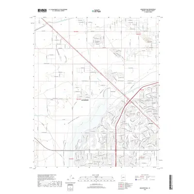
2018 Map of McMicken Dam
USGS Topo · Published 2018About this map
The rapid expansion of Surprise in the late 2010s is clearly visible in this survey, showcasing a landscape defined by large-scale water management and residential development. The McMicken Dam and its associated McMicken Dam Outlet Channel dominate the central terrain, while the Central Arizona Project Aqueduct cuts through the northern sections, illustrating the massive infrastructure required to support desert habitation. To the east, the settlement of Beardsley sits along the BNSF Railway, marking a corridor of historical transport that contrasts with the newer suburban grids spreading west. Beyond the developed neighborhoods, the landscape remains punctuated by natural features such as Bunker Peak and the winding Picacho Wash. This documentation captures a specific phase of Maricopa County’s growth, where modern irrigation canals like the Beardsley Canal meet the encroaching street networks of a growing metropolitan area.
Find a feature on this map
228 named features on this map. Tap any name to fly to it.
Don’t see what you’re looking for? This feature index may not catch every label — zoom into the map to look around manually.
Map Details
Editions of this 2018 McMicken Dam Map
This is the sole edition of this map. No revisions or reprints were ever made.
Other maps of this area

1954 · Phoenix
USGS Topo · 1:250,000

1957 · Phoenix
USGS Topo · 1:250,000

1957 · White Tank Mts. SE
USGS Topo · 1:24,000

1957 · White Tank Mts. NE
USGS Topo · 1:24,000

1957 · Calderwood Butte
USGS Topo · 1:24,000

1957 · McMicken Dam
USGS Topo · 1:24,000

1957 · El Mirage
USGS Topo · 1:24,000

1957 · Waddell
USGS Topo · 1:24,000

1957 · White Tank Mts.
USGS Topo · 1:62,500

1958 · Phoenix
USGS Topo · 1:250,000