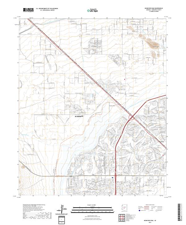
2021 Map of McMicken Dam
USGS Topo · Published 2021About this map
The McMicken Dam and its accompanying McMicken Dam Outlet Channel dominate this modern landscape near Surprise, Arizona. The area illustrates a complex intersection of water management and suburban expansion, featuring the massive Central Arizona Project Aqueduct and the Beardsley Canal. Residential developments like Tierra Buena Ln and numerous named streets such as W Surprise Farms Loop S spread across the desert floor, pressing against topographic features like Bunker Peak and Lake Bonita. In the northwest, the Volvo Proving Grounds and Grants Mine Rd hint at industrial and specialized land uses that precede the residential sprawl. Natural drainage through Picacho Wash and Trilby Wash is heavily modified by the extensive dam infrastructure designed to manage desert runoff for the growing community of Beardsley.
Find a feature on this map
123 named features on this map. Tap any name to fly to it.
Don’t see what you’re looking for? This feature index may not catch every label — zoom into the map to look around manually.
Map Details
Editions of this 2021 McMicken Dam Map
This is the sole edition of this map. No revisions or reprints were ever made.
Other maps of this area

1954 · Phoenix
USGS Topo · 1:250,000

1957 · Phoenix
USGS Topo · 1:250,000

1957 · White Tank Mts. SE
USGS Topo · 1:24,000

1957 · White Tank Mts. NE
USGS Topo · 1:24,000

1957 · Calderwood Butte
USGS Topo · 1:24,000

1957 · McMicken Dam
USGS Topo · 1:24,000

1957 · El Mirage
USGS Topo · 1:24,000

1957 · Waddell
USGS Topo · 1:24,000

1957 · White Tank Mts.
USGS Topo · 1:62,500

1958 · Phoenix
USGS Topo · 1:250,000