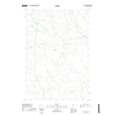
2018 Map of McNally Ridge
USGS Topo · Published 2018About this map
McNally Ridge and Maple Ridge dominate this interior Aroostook County landscape, defining a terrain shaped by an intricate network of waterways flowing through the North Woods. The small settlement at Pride sits near the upper reaches of the Saint Croix Stream, while numerous family-named and descriptive brooks, such as Roll Dam Brook and Boody Brook, suggest the historic importance of the logging industry and water-driven transport in the region.
Find a feature on this map
22 named features on this map. Tap any name to fly to it.
Don’t see what you’re looking for? This feature index may not catch every label — zoom into the map to look around manually.
Map Details
Editions of this 2018 McNally Ridge Map
This is the sole edition of this map. No revisions or reprints were ever made.
Other maps of this area

1935 · Howe Brook
USGS Topo · 1:48,000

1937 · Smyrna Mills
USGS Topo · 1:62,500

1939 · Howe Brook
USGS Topo · 1:62,500

1940 · Island Falls
USGS Topo · 1:62,500

1940 · Oxbow
USGS Topo · 1:62,500

1942 · Island Falls
USGS Topo · 1:62,500

1942 · Oxbow
USGS Topo · 1:62,500

1954 · Howe Brook
USGS Topo · 1:62,500

1954 · Presque Isle
USGS Topo · 1:250,000

1955 · Smyrna Mills
USGS Topo · 1:62,500
Featured Places
- Webbertown Township, ME
- Saint Croix Township, ME
- T7 R5 WELS, ME
- T8 R5 WELS, ME
- Pride, Saint Croix Township