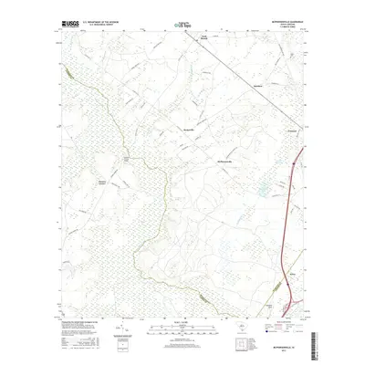
2017 Map of McPhersonville
USGS Topo · Published 2017About this map
Mcphersonville and its surrounding wetlands form the heart of this Lowcountry landscape, where the Coosawhatchie River and Tulifiny River carve through the coastal plain of Hampton and Jasper Counties. The map reveals a distribution of rural settlements like Barkerville, Davidson, and Possum Corner, often situated along historic corridors such as the Old Salkehatchie Hwy or near water features like Buckfield Pond. The layout of the land is heavily influenced by the drainage patterns of several branches, including Early Br and McPherson Cr, which feed into the larger river systems. Genealogists and local historians can locate specific landmarks such as the Zahler Cem near the northern boundary and the Possum Corner Bridge crossing. This survey details the intersection of modern transit and historical settlement patterns, particularly around the railway junction area of Yemassee and the smaller landings and crossings that define this part of the South Carolina coastal region.
Find a feature on this map
48 named features on this map. Tap any name to fly to it.
Don’t see what you’re looking for? This feature index may not catch every label — zoom into the map to look around manually.
Map Details
Editions of this 2017 McPhersonville Map
This is the sole edition of this map. No revisions or reprints were ever made.
Other maps of this area

1918 · Varnville
USGS Topo · 1:62,500

1918 · Yemassee
USGS Topo · 1:62,500

1919 · Pineland
USGS Topo · 1:62,500

1919 · Cummings
USGS Topo · 1:62,500

1943 · Pineland
USGS Topo · 1:62,500

1943 · Yemassee
USGS Topo · 1:62,500

1943 · Cummings
USGS Topo · 1:62,500

1944 · Varnville
USGS Topo · 1:62,500

1947 · Savannah
USGS Topo · 1:250,000

1948 · Savannah
USGS Topo · 1:250,000