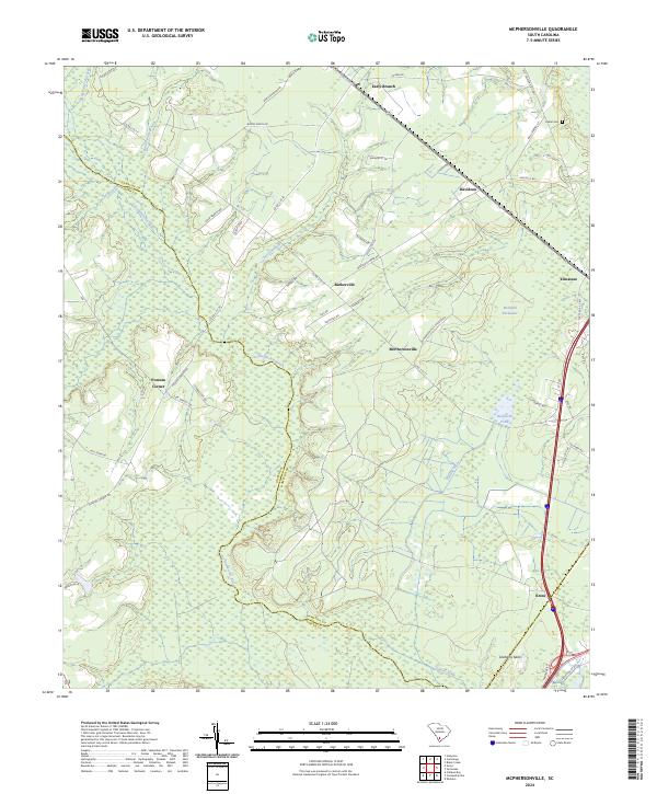
2024 Map of McPhersonville
USGS Topo · Published 2024About this map
The Coosawhatchie River and Tulifiny River systems define this Lowcountry landscape near the border of Hampton and Jasper counties. Centered on Mcphersonville, the area shows a pattern of scattered rural settlements connected by a web of local routes like Mcphersonville Church Rd and Davidson Tower Rd. The eastern corridor is dominated by the proximity of Yemassee and Kress, where major transportation arteries cut through the wetlands and forests. Small family and community landmarks such as Zahler Cem are tucked away near Davidson, while the low-lying terrain is marked by features like Buckfield Backwater and Buckfield Pond. This contemporary survey preserves the names of long-standing locales including Early Branch, Barkerville, and the evocative Possum Corner, documenting the enduring geography of South Carolina's coastal plain.
Find a feature on this map
54 named features on this map. Tap any name to fly to it.
Don’t see what you’re looking for? This feature index may not catch every label — zoom into the map to look around manually.
Map Details
Editions of this 2024 McPhersonville Map
This is the sole edition of this map. No revisions or reprints were ever made.
Other maps of this area

1918 · Varnville
USGS Topo · 1:62,500

1918 · Yemassee
USGS Topo · 1:62,500

1919 · Pineland
USGS Topo · 1:62,500

1919 · Cummings
USGS Topo · 1:62,500

1943 · Pineland
USGS Topo · 1:62,500

1943 · Yemassee
USGS Topo · 1:62,500

1943 · Cummings
USGS Topo · 1:62,500

1944 · Varnville
USGS Topo · 1:62,500

1947 · Savannah
USGS Topo · 1:250,000

1948 · Savannah
USGS Topo · 1:250,000