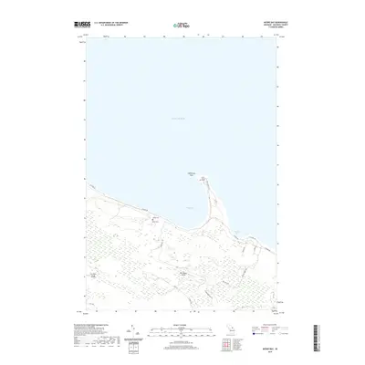
2019 Map of McRae Bay
USGS Topo · Published 2019About this map
Bois Blanc Island occupies this portion of the Straits of Mackinac, showing a landscape defined by its coastal access and interior forest tracks. The northern shoreline is punctuated by McRae Bay and Swedes Bay, where residential roads like N Shore Dr and E Huron Dr follow the contour of Lake Huron. The island's community infrastructure is concentrated in the northern and western sections, featuring local landmarks such as Olive Church Grove and the Bois Blanc Island Airport. Genealogists may find particular interest in the McRae Cem, situated near the bay that shares its name. The road network, including N Thompson Lake Rd and West Trl, suggests a transition from coastal activity to the more secluded interior of the island.
Find a feature on this map
20 named features on this map. Tap any name to fly to it.
Don’t see what you’re looking for? This feature index may not catch every label — zoom into the map to look around manually.
Map Details
Editions of this 2019 McRae Bay Map
This is the sole edition of this map. No revisions or reprints were ever made.
Other maps of this area

1932 · St Ignace NE
USGS Topo · 1:31,680

1955 · Cheboygan
USGS Topo · 1:250,000

1957 · Cheboygan
USGS Topo · 1:62,500

1957 · Mullett Lake
USGS Topo · 1:62,500

1958 · Cheboygan
USGS Topo · 1:250,000

1964 · Round Island
USGS Topo · 1:24,000
1964 · Goose Island
USGS Topo · 1:24,000
1964 · St. Martin Island
USGS Topo · 1:24,000

1964 · McRae Bay
USGS Topo · 1:24,000
1964 · Cedarville
USGS Topo · 1:24,000