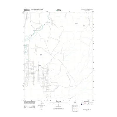
2011 Map of McTarnahan Hill
USGS Topo · Published 2011About this map
Johnson Lane and the expansive residential developments east of the Carson River define the character of this 2011 survey in Douglas County. The landscape transitions from the suburban grid of streets like Vicky Ln and Fuller Ave into the high terrain of Hot Springs Mountain and McTarnahan Hill. This survey captures the modern interface between established residential zones and the open desert valley, where access points like Bunker Hill Mine Rd and Brunswick Canyon Rd lead toward the more isolated eastern canyons. Of particular interest are the natural hydrology and landmarks such as the Saratoga Hot Spring and the McTarnahan Bridge, which crosses the river to connect the valley floor with the rising slopes of Onion Valley.
Find a feature on this map
59 named features on this map. Tap any name to fly to it.
Don’t see what you’re looking for? This feature index may not catch every label — zoom into the map to look around manually.
Map Details
Editions of this 2011 McTarnahan Hill Map
This is the sole edition of this map. No revisions or reprints were ever made.
Other maps of this area

1889 · Markleeville
USGS Topo · 1:125,000

1891 · Carson
USGS Topo · 1:125,000

1891 · Markleeville
USGS Topo · 1:125,000

1893 · Carson
USGS Topo · 1:125,000

1893 · Markleeville
USGS Topo · 1:125,000

1948 · Walker Lake
USGS Topo · 1:250,000

1956 · Freel Peak
USGS Topo · 1:62,500

1956 · Dayton
USGS Topo · 1:62,500

1956 · Carson City
USGS Topo · 1:62,500

1957 · Walker Lake
USGS Topo · 1:250,000