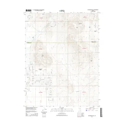
2014 Map of McTarnahan Hill
USGS Topo · Published 2014About this map
Johnson Lane anchors this portion of the Carson Valley, serving as a modern residential hub at the edge of Nevada’s high-desert canyons. The landscape is defined by the transition from the developed streets of the community to the dramatic elevation changes of the surrounding terrain, including McTarnahan Hill and Hot Springs Mtn. Historically significant water features like the Mexican Ditch and the Carson River trace the path of essential resources through this arid environment, while Saratoga Hot Spring highlights the geothermal activity characteristic of the region.
Find a feature on this map
81 named features on this map. Tap any name to fly to it.
Don’t see what you’re looking for? This feature index may not catch every label — zoom into the map to look around manually.
Map Details
Editions of this 2014 McTarnahan Hill Map
This is the sole edition of this map. No revisions or reprints were ever made.
Other maps of this area

1889 · Markleeville
USGS Topo · 1:125,000

1891 · Carson
USGS Topo · 1:125,000

1891 · Markleeville
USGS Topo · 1:125,000

1893 · Carson
USGS Topo · 1:125,000

1893 · Markleeville
USGS Topo · 1:125,000

1948 · Walker Lake
USGS Topo · 1:250,000

1956 · Freel Peak
USGS Topo · 1:62,500

1956 · Dayton
USGS Topo · 1:62,500

1956 · Carson City
USGS Topo · 1:62,500

1957 · Walker Lake
USGS Topo · 1:250,000