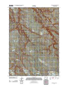
2011 Map of Meadow Lake
USGS Topo · Published 2011About this map
Robinson Valley occupies the southwestern reaches of this high desert terrain in Harney County, characterized by a complex network of ephemeral water sources and seasonal basins. The landscape is dotted with several named dry lake beds and reservoirs, including Moon Lake, Green Lake, and the centrally located Deep Lake. These features, along with Alex Spring Reservoir, suggest a reliance on managed water points in an area dominated by open range and low-relief drainage systems like Buzzard Creek.
Find a feature on this map
13 named features on this map. Tap any name to fly to it.
Don’t see what you’re looking for? This feature index may not catch every label — zoom into the map to look around manually.
Map Details
Editions of this 2011 Meadow Lake Map
This is the sole edition of this map. No revisions or reprints were ever made.
Other maps of this area

1955 · Burns
USGS Topo · 1:250,000

1955 · Adel
USGS Topo · 1:250,000

1957 · Adel
USGS Topo · 1:250,000

1958 · Burns
USGS Topo · 1:250,000

1958 · Adel
USGS Topo · 1:250,000

1959 · Burns
USGS Topo · 1:250,000

1962 · Adel
USGS Topo · 1:250,000

1971 · Clover Swale
USGS Topo · 1:24,000
1971 · Keg Sprs Valley West
USGS Topo · 1:24,000
1971 · Balls Lake
USGS Topo · 1:24,000