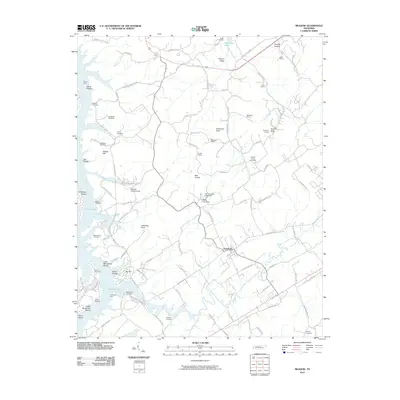
2010 Map of Meadow
USGS Topo · Published 2010About this map
Greenback and the surrounding Tennessee landscape are defined by the convergence of water and industry in this 2010 topographic study. The Little Tennessee River and Tellico Lake dominate the southwestern quadrant, where the submerged geography of Lower Morganton Shoals and Upper Morganton Shoals hints at the historic river navigation that preceded the damming. The map serves as a vital record for genealogists, detailing numerous family and community burial grounds such as Unitia Cemetery, Axley Cemetery, and Morganton Cemetery. Local industry is prominent through a cluster of resource extraction sites including Buzzards Roost Quarry, Crisp Quarry, and Alexander Quarry. Higher elevations like Alexander Knob and the Red Knobs provide a clear view of the transition from the river valley into the broken terrain of Hickory Valley, while the National Camp Ground reflects the area's social and religious heritage.
Find a feature on this map
99 named features on this map. Tap any name to fly to it.
Don’t see what you’re looking for? This feature index may not catch every label — zoom into the map to look around manually.
Map Details
Editions of this 2010 Meadow Map
This is the sole edition of this map. No revisions or reprints were ever made.
Other maps of this area

1895 · Loudon
USGS Topo · 1:125,000

1935 · Binfield
USGS Topo · 1:24,000

1935 · Meadow
USGS Topo · 1:24,000

1935 · Lenoir City
USGS Topo · 1:24,000
1935 · Tallassee
USGS Topo · 1:24,000
1935 · Vonore
USGS Topo · 1:24,000
1936 · Madisonville
USGS Topo · 1:24,000

1936 · Louisville
USGS Topo · 1:24,000

1936 · Friendship
USGS Topo · 1:48,000

1936 · Loudon
USGS Topo · 1:24,000