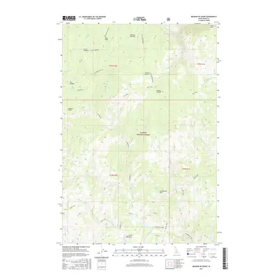
2017 Map of Meadow of Doubt
USGS Topo · Published 2017About this map
Payette National Forest encompasses this high-altitude landscape in central Idaho, where the remote Chamberlain Basin serves as a primary geographical anchor. The area is defined by a network of meadows and ridges, including the evocative Meadow of Doubt and the expansive White Bird Meadow. Human presence is concentrated at the Chamberlain USFS Airport, a vital backcountry airstrip located near the confluence of Ranch Creek and Chamberlain Creek.
Find a feature on this map
40 named features on this map. Tap any name to fly to it.
Don’t see what you’re looking for? This feature index may not catch every label — zoom into the map to look around manually.
Map Details
Editions of this 2017 Meadow of Doubt Map
This is the sole edition of this map. No revisions or reprints were ever made.
Other maps of this area

1956 · Elk City
USGS Topo · 1:250,000

1960 · Elk City
USGS Topo · 1:250,000

1974 · Meadow Of Doubt
USGS Topo · 1:24,000

1978 · Mosquito Peak
USGS Topo · 1:24,000

1978 · Arctic Point
USGS Topo · 1:24,000

1978 · Hida Point
USGS Topo · 1:24,000

1978 · Wapiti Creek
USGS Topo · 1:24,000

1978 · Sheep Hill
USGS Topo · 1:24,000
1978 · Lodgepole Creek
USGS Topo · 1:24,000
1979 · Whitewater Ranch
USGS Topo · 1:24,000