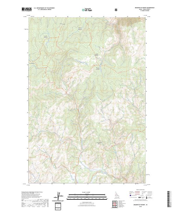
2024 Map of Meadow of Doubt
USGS Topo · Published 2024About this map
Payette National Forest encompasses this high-altitude landscape in the heart of the Frank Church-River of No Return Wilderness. The map reveals a high-country network of subalpine meadows, such as Dillinger Meadows, Harlan Meadows, and the uniquely named Meadow of Doubt. This area is characterized by its remote drainages, where the West Fork Chamberlain Creek and South Fork Dillinger Creek originate along prominent ridgelines like Hida Ridge. The topography is navigated by a series of pack trails, including the Artic Point Trl and Chamberlain Trl, which connect high points like Artic Point to deep valleys like Chamberlain Basin. This 2024 survey documents the enduring wilderness character of Idaho County, showing a landscape defined by names that reflect the experiences of early travelers and forest rangers.
Find a feature on this map
35 named features on this map. Tap any name to fly to it.
Don’t see what you’re looking for? This feature index may not catch every label — zoom into the map to look around manually.
Map Details
Editions of this 2024 Meadow of Doubt Map
This is the sole edition of this map. No revisions or reprints were ever made.
Other maps of this area

1956 · Elk City
USGS Topo · 1:250,000

1960 · Elk City
USGS Topo · 1:250,000

1974 · Meadow Of Doubt
USGS Topo · 1:24,000

1978 · Mosquito Peak
USGS Topo · 1:24,000

1978 · Arctic Point
USGS Topo · 1:24,000

1978 · Hida Point
USGS Topo · 1:24,000

1978 · Wapiti Creek
USGS Topo · 1:24,000

1978 · Sheep Hill
USGS Topo · 1:24,000
1978 · Lodgepole Creek
USGS Topo · 1:24,000
1979 · Whitewater Ranch
USGS Topo · 1:24,000