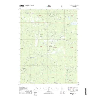
2018 Map of Meadow Valley
USGS Topo · Published 2018About this map
Spanish Ranch and the community of Meadow Valley occupy a high-elevation basin within the Plumas National Forest. This 2018 survey reveals a landscape deeply defined by its timber and mining heritage, visible in the network of logging roads like Old Mill and Meyer spur, as well as several topographic markers of early industry such as Boring Mill Ravine and Taylor Gulch. The western edge is dominated by the ascent toward Spanish Peak, while the Pacific Crest National Scenic Trail winds across the southwestern terrain near Bucks Summit.
Find a feature on this map
89 named features on this map. Tap any name to fly to it.
Don’t see what you’re looking for? This feature index may not catch every label — zoom into the map to look around manually.
Map Details
Editions of this 2018 Meadow Valley Map
This is the sole edition of this map. No revisions or reprints were ever made.
Other maps of this area

1886 · Honey Lake
USGS Topo · 1:250,000

1886 · Lassen Peak
USGS Topo · 1:250,000

1888 · Bidwell Bar
USGS Topo · 1:125,000

1891 · Bidwell Bar
USGS Topo · 1:125,000

1891 · Downieville
USGS Topo · 1:125,000

1891 · Honey Lake
USGS Topo · 1:250,000

1892 · Lassen Peak
USGS Topo · 1:250,000

1893 · Bidwell Bar
USGS Topo · 1:125,000

1893 · Honey Lake
USGS Topo · 1:250,000

1893 · Downieville
USGS Topo · 1:125,000